Astronomy:Explorer 21
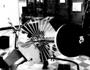
 Image of Explorer 21. | |||||||||||||||||
| Mission type | Earth science | ||||||||||||||||
|---|---|---|---|---|---|---|---|---|---|---|---|---|---|---|---|---|---|
| Operator | NASA | ||||||||||||||||
| COSPAR ID | 1964-060A[1] | ||||||||||||||||
| SATCAT no. | 889 | ||||||||||||||||
| Spacecraft properties | |||||||||||||||||
| Manufacturer | GSFC | ||||||||||||||||
| Launch mass | 138 kg (304 lb) | ||||||||||||||||
| Start of mission | |||||||||||||||||
| Launch date | 4 October 1964, 03:45 UTC[2][3] | ||||||||||||||||
| Rocket | Delta C | ||||||||||||||||
| Launch site | Cape Canaveral Air Force Station LC-17A[4] | ||||||||||||||||
| End of mission | |||||||||||||||||
| Last contact | October 13, 1965 | ||||||||||||||||
| Decay date | January 1, 1966 | ||||||||||||||||
| Orbital parameters | |||||||||||||||||
| Reference system | Geocentric | ||||||||||||||||
| Regime | Highly Elliptical | ||||||||||||||||
| Eccentricity | 0.86478[1] | ||||||||||||||||
| Perigee altitude | 917 km (570 mi)[1] | ||||||||||||||||
| Apogee altitude | 94,288 km (58,588 mi)[1] | ||||||||||||||||
| Inclination | 33.7°[1] | ||||||||||||||||
| Period | 2,080 minutes[1] | ||||||||||||||||
| Epoch | 3 October 1964[1] | ||||||||||||||||
| Instruments | |||||||||||||||||
| |||||||||||||||||
Explorers | |||||||||||||||||
Explorer 21, also called IMP-B and Interplanetary Monitoring Platform IMP-B, was an United States satellite launched as part of Explorers program. Explorer 21 was launched on 4 October 1964 from Cape Canaveral,[5] Florida, United States , with a Delta rocket. Explorer 21 was the second satellite of the Interplanetary Monitoring Platform.
Mission
Explorer 21 was a solar cell and chemical-battery powered spacecraft instrumented for interplanetary and distant magnetospheric studies of energetic particles, cosmic rays, magnetic fields, and plasmas. Each normal telemetry sequence of 81.9 s in duration consisted of 795 data bits. After every third normal sequence there was an 81.9-s interval of rubidium vapor magnetometer analog data transmission. Initial spacecraft parameters included a local time of apogee at noon, a spin rate of 14.6 rpm, and a spin direction of 41.4-deg right ascension and 47.4-deg declination. The significant deviation of the spin rate and direction from the planned values and the achievement of an apogee of less than half the planned value adversely affected data usefulness.
Otherwise, spacecraft systems performed well, with nearly complete data transmission for the first 4 months and for the sixth month after launch. Data transmission was intermittent for other times, and the final transmission occurred on October 13, 1965.[1]
References
- ↑ 1.0 1.1 1.2 1.3 1.4 1.5 1.6 1.7 "IMP-B". NSSDC Master Catalog. NASA Goddard Space Flight Center. https://nssdc.gsfc.nasa.gov/nmc/spacecraft/display.action?id=1964-060A.
 This article incorporates text from this source, which is in the public domain.
- ↑ "Jonathan's Space Page". http://www.planet4589.org/space/log/launchlog.txt.
- ↑ "Letter dated 22 December 1964 from the Permanent Representative of the United States of America addressed to the Secretary-General". COMMITTEE ON THE PEACEFUL USES OF OUTER SPACE (64-28156). http://www.unoosa.org/oosa/download.do?file_uid=1026. Retrieved June 9, 2018.[yes|permanent dead link|dead link}}]
- ↑ "NASA'S YEAR". FLIGHT International. http://www.flightglobal.com/pdfarchive/view/1965/1965%20-%200052.html. Retrieved June 9, 2018.
- ↑ "Explorer-21 Satellite Falls Far Short Of Orbital Goal". The Palm Beach Post. October 5, 1964. https://news.google.com/newspapers?nid=1964&dat=19641005&id=AGYyAAAAIBAJ&sjid=JrcFAAAAIBAJ&pg=2453,1341098. Retrieved June 9, 2018.


