Earth:Canal Parkent
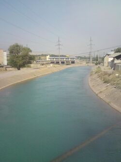
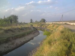
The Canal Parkent is a large hydraulic structure built in the Tashkent region. The canal passes through the territories of Bostonliq, Parkent, Yuqori Chirchiq, and Ohangaron districts of the region. The Chirchiq hydroelectric power station cascade (Gazalkent hydro junction) built on the Chirchiq river takes water from the canal's 1st section (69 km) constructed between 1975-1983, and the 2nd section (14.3 km) built between 1988-1997. The project's total length is 96 km, with 83.3 km allocated for use. The canal's width in the upper section is 6-7 m, with a depth of 3.6-3.8 m. In the lower section, the width narrows to 2-2.5 m and 2.1-2.4 m in some places. The upper section has a maximum water consumption of 51-57 m³/s, and the lower section's maximum consumption is 7-10.4 m³/s. The canal was constructed across a complicated terrain with various geological conditions, including loamy soil, rocks, and boulders. Concrete lining was used for 38.7 km of the canal's length. In some areas, the canal was dug up to 30-40 m deep or built up to 20 m high. The canal has 12 culverts, 8 aqueducts, 1 water intake structure, 1 railway bridge, 86 water outlets, 7 pumping stations, 8 stone quarries, 8 dams, 9 sluice gates, 46 canal bottom culverts, 21 road bridges, and other structures. The canal irrigates over 30,000 hectares of farmland, including vegetable gardens, cereals, cotton, and melon fields on the left bank of the Chirchiq river. Ziyomiddin Artukmetov was the project's author. [1]
References
- ↑ OʻzME. The first volume. Tashkent, 2000
| This box has not been added since it needs an appropriate category |


