File:Aerial image of the Hallig Süderoog at high tide.jpg
Original file (5,568 × 3,712 pixels, file size: 6.61 MB, MIME type: image/jpeg)
This file is from a shared repository and may be used by other projects. The description on its file description page there is shown below.
Summary
DescriptionAerial image of the Hallig Süderoog at high tide.jpg |
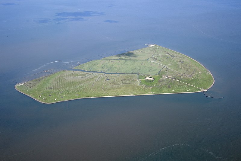
English: Aerial image of the Hallig Süderoog approximately 45 minutes before high tide
Deutsch: Luftbild der Hallig Süderoog etwa 45 Minuten vor Hochwasser |
Date | |
Source | Own work |
Author | Carsten Steger |
Camera location | 54° 27′ 35.81″ N, 8° 31′ 02.74″ E | View this and other nearby images on: OpenStreetMap | 54.459946; 8.517429 |
---|
Object location | 54° 27′ 48″ N, 8° 33′ 11″ E | View this and other nearby images on: OpenStreetMap | 54.463333; 8.553056 |
---|
This place is a UNESCO World Heritage Site, listed as
Wadden Sea.
العربية | asturianu | беларуская | беларуская (тарашкевіца) | বাংলা | català | čeština | dansk | Deutsch | English | español | euskara | فارسی | français | avañe'ẽ | עברית | hrvatski | magyar | bahasa Indonesia | italiano | 日本語 | 한국어 | latviešu | македонски | മലയാളം | مازِرونی | Nederlands | polski | português | português do Brasil | română | русский | sicilianu | slovenčina | slovenščina | Türkçe | українська | Tiếng Việt | 中文 | 中文(中国大陆) | 中文(简体) | 中文(繁體) | 中文(台灣) | +/− |
Licensing
- You are free:
- to share – to copy, distribute and transmit the work
- to remix – to adapt the work
- Under the following conditions:
- attribution – You must give appropriate credit, provide a link to the license, and indicate if changes were made. You may do so in any reasonable manner, but not in any way that suggests the licensor endorses you or your use.
- share alike – If you remix, transform, or build upon the material, you must distribute your contributions under the same or compatible license as the original.
This image has been assessed using the Quality image guidelines and is considered a Quality image.
العربية ∙ جازايرية ∙ беларуская ∙ беларуская (тарашкевіца) ∙ български ∙ বাংলা ∙ català ∙ čeština ∙ Cymraeg ∙ Deutsch ∙ Schweizer Hochdeutsch ∙ Zazaki ∙ Ελληνικά ∙ English ∙ Esperanto ∙ español ∙ eesti ∙ euskara ∙ فارسی ∙ suomi ∙ français ∙ galego ∙ עברית ∙ हिन्दी ∙ hrvatski ∙ magyar ∙ հայերեն ∙ Bahasa Indonesia ∙ italiano ∙ 日本語 ∙ Jawa ∙ ქართული ∙ 한국어 ∙ kurdî ∙ Lëtzebuergesch ∙ lietuvių ∙ македонски ∙ മലയാളം ∙ मराठी ∙ Bahasa Melayu ∙ Nederlands ∙ Norfuk / Pitkern ∙ polski ∙ português ∙ português do Brasil ∙ rumantsch ∙ română ∙ русский ∙ sicilianu ∙ slovenčina ∙ slovenščina ∙ shqip ∙ српски / srpski ∙ svenska ∙ தமிழ் ∙ తెలుగు ∙ ไทย ∙ Tagalog ∙ toki pona ∙ Türkçe ∙ українська ∙ vèneto ∙ Tiếng Việt ∙ 中文 ∙ 中文(简体) ∙ 中文(繁體) ∙ +/− |
some value
54°27'35.806"N, 8°31'2.744"E
15 June 2021
54°27'47.999"N, 8°33'11.002"E
0.002 second
11
48 millimetre
400
image/jpeg
885aae4b2e17ea0deaa37a82fc73315be22f33b9
6,926,143 byte
3,712 pixel
5,568 pixel
File history
Click on a date/time to view the file as it appeared at that time.
Date/Time | Thumbnail | Dimensions | User | Comment | |
---|---|---|---|---|---|
current | 07:59, 22 August 2022 | 5,568 × 3,712 (6.61 MB) | imagescommonswiki>Carsten Steger | Reverted to version as of 15:16, 8 July 2021 (UTC) |
File usage
The following file is a duplicate of this file (more details):
- File:Aerial image of the Hallig Süderoog at high tide.jpg from Wikimedia Commons
The following page uses this file:
Metadata
This file contains additional information, probably added from the digital camera or scanner used to create or digitize it.
If the file has been modified from its original state, some details may not fully reflect the modified file.
Camera manufacturer | NIKON CORPORATION |
---|---|
Camera model | NIKON D5 |
Author | Carsten Steger |
Copyright holder | This work is licensed under the Creative Commons Attribution ShareAlike 4.0 International License. To view a copy of this license, visit https://creativecommons.org/licenses/by-sa/4.0/. |
Exposure time | 1/500 sec (0.002) |
F Number | f/11 |
ISO speed rating | 400 |
Date and time of data generation | 16:43, 15 June 2021 |
Lens focal length | 48 mm |
Orientation | Normal |
Horizontal resolution | 300 dpi |
Vertical resolution | 300 dpi |
Software used | Ver.1.30 |
File change date and time | 16:43, 15 June 2021 |
Y and C positioning | Co-sited |
Exposure Program | Normal program |
Exif version | 2.31 |
Date and time of digitizing | 16:43, 15 June 2021 |
Meaning of each component |
|
Image compression mode | 4 |
APEX exposure bias | 0 |
Maximum land aperture | 4.2 APEX (f/4.29) |
Metering mode | Pattern |
Light source | Unknown |
Flash | Flash did not fire |
DateTime subseconds | 34 |
DateTimeOriginal subseconds | 34 |
DateTimeDigitized subseconds | 34 |
Supported Flashpix version | 1 |
Color space | sRGB |
Sensing method | One-chip color area sensor |
File source | Digital still camera |
Scene type | A directly photographed image |
Custom image processing | Normal process |
Exposure mode | Auto exposure |
White balance | Auto white balance |
Focal length in 35 mm film | 48 mm |
Scene capture type | Standard |
Scene control | None |
Contrast | Normal |
Saturation | Normal |
Sharpness | Normal |
Subject distance range | Unknown |
GPS tag version | 0.0.3.2 |
URL for copyright license | https://creativecommons.org/licenses/by-sa/4.0/ |
Rating (out of 5) | 0 |