File:Air Raid Damage Map - East Marylebone.jpg
From HandWiki
Size of this preview: 479 × 599 pixels. Other resolutions: 384 × 480 pixels | 1,783 × 2,229 pixels.
Original file (1,783 × 2,229 pixels, file size: 2.08 MB, MIME type: image/jpeg)
Summary
| Description |
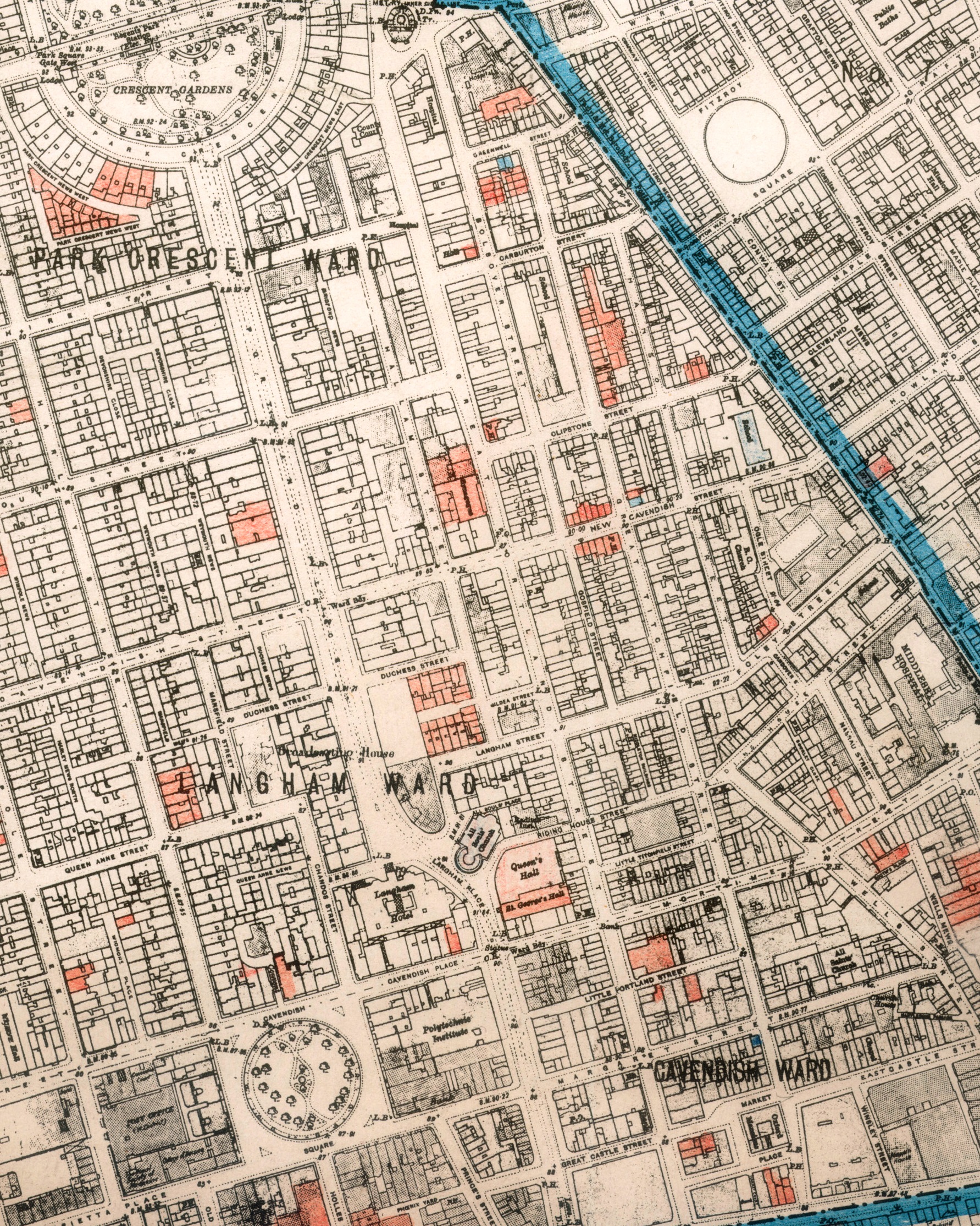
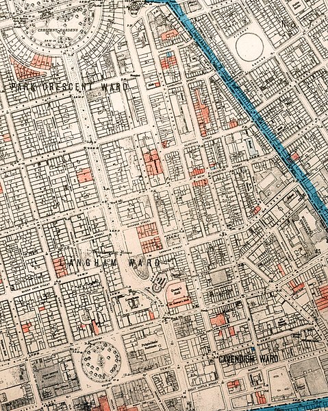
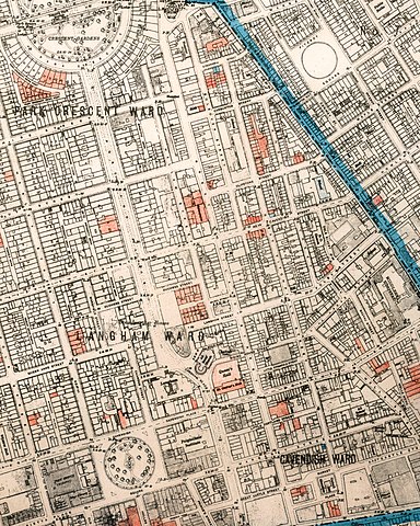
English: Extract of SMBC Air Raid Damage Map showing WWII Blitz damage to Eastern Marylebone (then in the Borough of St Marylebone) |
| Date | circa 1942 |
| Source | Westminster City Archives - http://www.westminster.gov.uk/services/libraries/archives/ - Marylebone Civil Defence collection |
| Author | SMBC |
| Permission (Reusing this file) |
Contact http://www.westminster.gov.uk/services/libraries/archives/ archive copy at the Wayback Machine for more information
Licensing
This file is licensed under the Creative Commons Attribution-Share Alike 3.0 Unported license.
- You are free:
- to share – to copy, distribute and transmit the work
- to remix – to adapt the work
- Under the following conditions:
- attribution – You must give appropriate credit, provide a link to the license, and indicate if changes were made. You may do so in any reasonable manner, but not in any way that suggests the licensor endorses you or your use.
- share alike – If you remix, transform, or build upon the material, you must distribute your contributions under the same or compatible license as the original.
File history
Click on a date/time to view the file as it appeared at that time.
| Date/Time | Thumbnail | Dimensions | User | Comment | |
|---|---|---|---|---|---|
| current | 06:44, 13 September 2010 | | 1,783 × 2,229 (2.08 MB) | imagescommonswiki>Portlandvillage | {{Information |Description={{en|1=Extract of SMBC Air Raid Damage Map showing WWII Blitz damage to Eastern Marylebone (then in the Borough of St Marylebone)}} |Source=Westminster City Archives - http://www.westminster.gov.uk/services/libraries/archives/ | |
File usage
The following file is a duplicate of this file (more details):
- File:Air Raid Damage Map - East Marylebone.jpg from Wikimedia Commons
The following page uses this file:

