File:Argentina topo blank.jpg
From HandWiki

Size of this preview: 445 × 599 pixels. Other resolutions: 357 × 480 pixels | 1,600 × 2,153 pixels.
Original file (1,600 × 2,153 pixels, file size: 565 KB, MIME type: image/jpeg)
| Description |
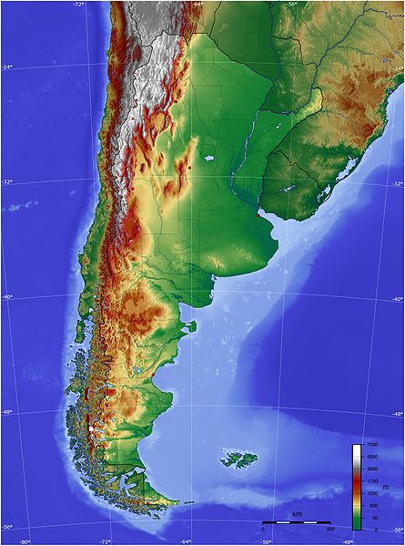
Español: Mapa de Argentina con su relieve
English: Map of Argentina with its terrain levels |
||||||||||
| Date | 9/06/2006 | ||||||||||
| Source | See below | ||||||||||
| Author | Captain Blood | ||||||||||
| Permission (Reusing this file) |
|

File history
Click on a date/time to view the file as it appeared at that time.
| Date/Time | Thumbnail | Dimensions | User | Comment | |
|---|---|---|---|---|---|
| current | 16:45, 13 May 2009 | | 1,600 × 2,153 (565 KB) | imagescommonswiki>Keysanger | reverted. (Deleted yellow line in the Straits of Magellan, added the definitive end of the controversial border at the Beagle Channel and marked with a white box the (last) undefined border zone as agreed both countries.) |
File usage
The following file is a duplicate of this file (more details):
- File:Argentina topo blank.jpg from Wikimedia Commons
The following page uses this file:

