File:C80020s1 Ant.Map Shackleton Range.jpg
From HandWiki

Size of this preview: 800 × 539 pixels. Other resolutions: 640 × 431 pixels | 4,806 × 3,239 pixels.
Original file (4,806 × 3,239 pixels, file size: 2.14 MB, MIME type: image/jpeg)
Summary
| Description |
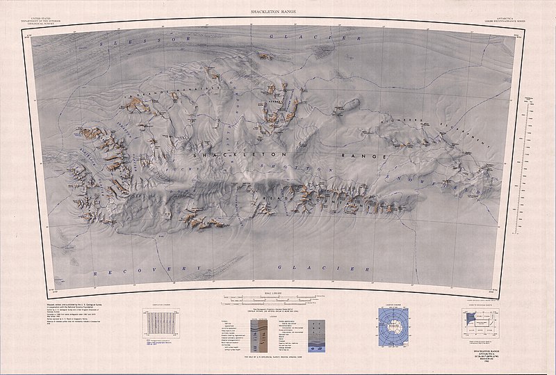
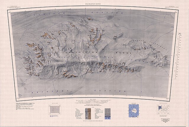
English: 1:250,000-scale topographic reconnaissance map of the Shackleton Range from 20°-31°W to 80°-81°S in Antarctica. Mapped, edited and published by the U.S. Geological Survey in cooperation with the National Science Foundation. |
|||
| Date | ||||
| Source | http://usarc.usgs.gov/drg_dload.shtml | |||
| Author | United States Geological Survey | |||
| Permission (Reusing this file) |
|
File history
Click on a date/time to view the file as it appeared at that time.
| Date/Time | Thumbnail | Dimensions | User | Comment | |
|---|---|---|---|---|---|
| current | 07:59, 18 February 2013 | | 4,806 × 3,239 (2.14 MB) | imagescommonswiki>4ing | == {{int:filedesc}} == {{Information |description={{en|1=1:250,000-scale topographic reconnaissance map of the Shackleton Range from 20°-31°W to 80°-81°S in Antarctica. Mapped, edited and published by the U.S. Geological Survey in cooperation with ... |
File usage
The following file is a duplicate of this file (more details):
- File:C80020s1 Ant.Map Shackleton Range.jpg from Wikimedia Commons
The following 2 pages use this file:

