File:Douglas B-18 Bolo ‘BI-24’ (37-029) (N52056) (29903884395).jpg
From HandWiki
Size of this preview: 800 × 357 pixels. Other resolutions: 640 × 286 pixels | 5,315 × 2,371 pixels.
Original file (5,315 × 2,371 pixels, file size: 11.32 MB, MIME type: image/jpeg)
Summary
| Description |
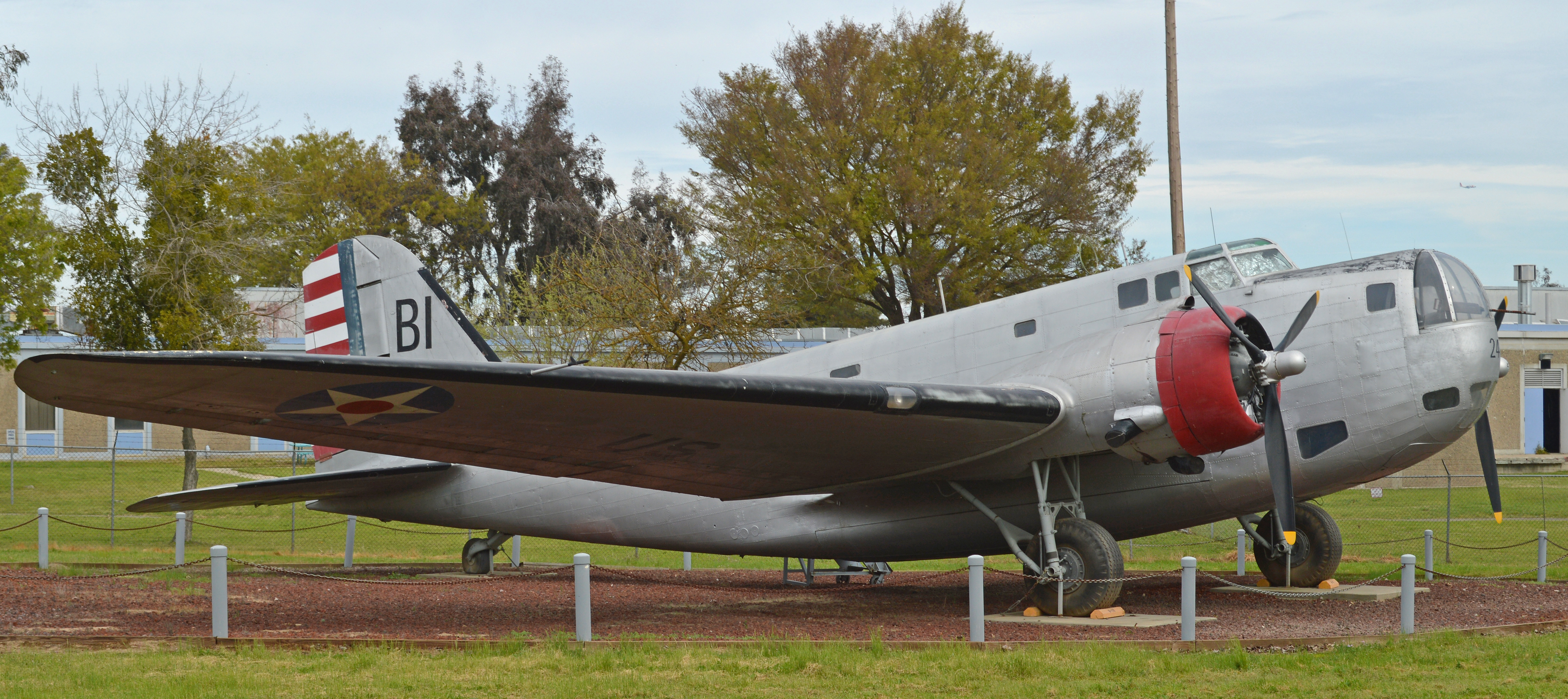
c/n 1890. Full US military serial 37-029. Of the five preserved Bolos, this is the only straight B-18, the others are either B-18A or B-18B models. Another B-18 exists in the Kohala Mountains, Hawaii where it crashed in 1941. Although stripped for parts (the nose turret was used in the restoration of 37-029 seen here) it may yet be recovered for display in Honolulu. ’37-029’ is on display at the Castle Air Museum, Atwater, CA. 4th March 2016 |
| Date | |
| Source | Douglas B-18 Bolo ‘BI-24’ [37-029] (N52056) |
| Author | Alan Wilson from Stilton, Peterborough, Cambs, UK |
| Camera location | | View this and other nearby images on: OpenStreetMap |
|---|
Licensing
This file is licensed under the Creative Commons Attribution-Share Alike 2.0 Generic license.
- You are free:
- to share – to copy, distribute and transmit the work
- to remix – to adapt the work
- Under the following conditions:
- attribution – You must give appropriate credit, provide a link to the license, and indicate if changes were made. You may do so in any reasonable manner, but not in any way that suggests the licensor endorses you or your use.
- share alike – If you remix, transform, or build upon the material, you must distribute your contributions under the same or compatible license as the original.
| This image was originally posted to Flickr by Hawkeye UK at https://flickr.com/photos/65001151@N03/29903884395. It was reviewed on 24 September 2016 by FlickreviewR and was confirmed to be licensed under the terms of the cc-by-sa-2.0. |
File history
Click on a date/time to view the file as it appeared at that time.
| Date/Time | Thumbnail | Dimensions | User | Comment | |
|---|---|---|---|---|---|
| current | 15:30, 28 August 2022 | | 5,315 × 2,371 (11.32 MB) | imagescommonswiki>NiD.29 | Cropped 1 % horizontally, 34 % vertically using CropTool with precise mode. |
File usage
The following file is a duplicate of this file (more details):
- File:Douglas B-18 Bolo ‘BI-24’ (37-029) (N52056) (29903884395).jpg from Wikimedia Commons
The following page uses this file:


_(N52056)_(29903884395).jpg)
_(N52056)_(29903884395).jpg&action=edit&redlink=1)
_(N52056)_(29903884395).jpg)
_(N52056)_(29903884395).jpg&action=mzwi)
_(N52056)_(29903884395).jpg¶ms=037.365723_N_-120.579124_E_globe:Earth_type:camera_source:Flickr_&language=en)
_(N52056)_(29903884395).jpg)
_(N52056)_(29903884395).jpg)
_(N52056)_(29903884395).jpg)
_(N52056)_(29903884395).jpg&action=info)