File:Haima 2016-10-19 0340Z.png
From HandWiki

Size of this preview: 450 × 600 pixels. Other resolutions: 360 × 480 pixels | 3,000 × 4,000 pixels.
Original file (3,000 × 4,000 pixels, file size: 15.7 MB, MIME type: image/png)
Summary
| Description |
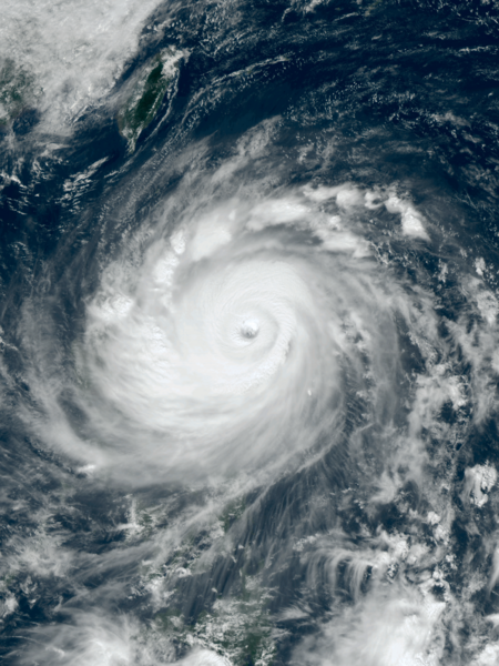
English: Typhoon Haima approaching the Philippines at peak intensity on October 19, 2016. |
| Date | |
| Source | RealEarth™ |
| Author | AHI image captured by the Japan Meteorology Agency’s Himawari-8 satellite |
| Camera location | | View this and other nearby images on: OpenStreetMap |
|---|
Licensing
This image was produced by the SSEC/CIMSS, University of Wisconsin–Madison. All the images published on their website can be freely used, as long as the source is acknowledged. (disclaimer (archive))
|
 |

File history
Click on a date/time to view the file as it appeared at that time.
| Date/Time | Thumbnail | Dimensions | User | Comment | |
|---|---|---|---|---|---|
| current | 20:16, 16 December 2022 | | 3,000 × 4,000 (15.7 MB) | imagescommonswiki>TheWxResearcher | 500m resolution |
File usage
The following file is a duplicate of this file (more details):
- File:Haima 2016-10-19 0340Z.png from Wikimedia Commons
The following page uses this file:

