File:JamaicaOMC.png
From HandWiki

Size of this preview: 800 × 420 pixels. Other resolutions: 640 × 336 pixels | 970 × 509 pixels.
Original file (970 × 509 pixels, file size: 27 KB, MIME type: image/png)
Summary
| Description |
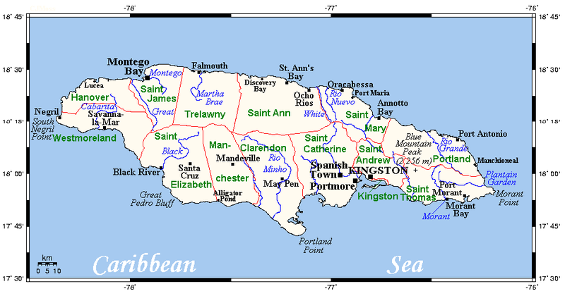
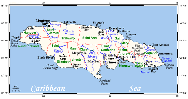
English: A map showing Jamaica's cities, main towns, parishes and rivers. |
| Date | 18 July 2008 (original upload date) |
| Source | This map's source is here, with the uploader's modifications, and the GMT homepage says that the tools are released under the GNU General Public License. |
| Author | Kelisi at English Wikipedia |
Licensing
Kelisi at the English-language Wikipedia, the copyright holder of this work, hereby publishes it under the following license:
| This file is licensed under the Creative Commons Attribution-Share Alike 3.0 Unported license. Subject to disclaimers. | ||
| Attribution: Kelisi at the English-language Wikipedia | ||
| ||
| This licensing tag was added to this file as part of the GFDL licensing update. |

|
Permission is granted to copy, distribute and/or modify this document under the terms of the GNU Free Documentation License, Version 1.2 or any later version published by the Free Software Foundation; with no Invariant Sections, no Front-Cover Texts, and no Back-Cover Texts. A copy of the license is included in the section entitled GNU Free Documentation License. Subject to disclaimers. |
The map has been created with the Generic Mapping Tools: https://www.generic-mapping-tools.org/ using one or more of these public-domain datasets for the relief:
|

|
Permission is granted to copy, distribute and/or modify this document under the terms of the GNU Free Documentation License, Version 1.2 or any later version published by the Free Software Foundation; with no Invariant Sections, no Front-Cover Texts, and no Back-Cover Texts. A copy of the license is included in the section entitled GNU Free Documentation License. |
| This file is licensed under the Creative Commons Attribution-Share Alike 3.0 Unported license. | ||
| ||
| This licensing tag was added to this file as part of the GFDL licensing update. |
Original upload log
Transferred from en.wikipedia to Commons by Quadell using CommonsHelper.
The original description page was here. All following user names refer to en.wikipedia.
- 2008-07-18 19:07 Kelisi 970×509× (27641 bytes) Same author, same source, same licence.
- 2008-07-18 16:14 Kelisi 970×510× (25590 bytes) A map showing Jamaica's cities, main towns, parishes and rivers. This map's source is [http://www.aquarius.ifm-geomar.de/ here], with the uploader's modifications, and the [http://gmt.soest.hawaii.edu/ GMT homepage] says that the tools are r
File history
Click on a date/time to view the file as it appeared at that time.
| Date/Time | Thumbnail | Dimensions | User | Comment | |
|---|---|---|---|---|---|
| current | 10:14, 24 June 2013 | | 970 × 509 (27 KB) | imagescommonswiki>File Upload Bot (Magnus Manske) | Transfered from en.wikipedia by User:Quadell using CommonsHelper |
File usage
The following file is a duplicate of this file (more details):
- File:JamaicaOMC.png from Wikimedia Commons
The following 2 pages use this file:

