File:Java Topography.png
From HandWiki

Size of this preview: 800 × 504 pixels. Other resolutions: 640 × 403 pixels | 2,688 × 1,693 pixels.
Original file (2,688 × 1,693 pixels, file size: 1.16 MB, MIME type: image/png)
Summary
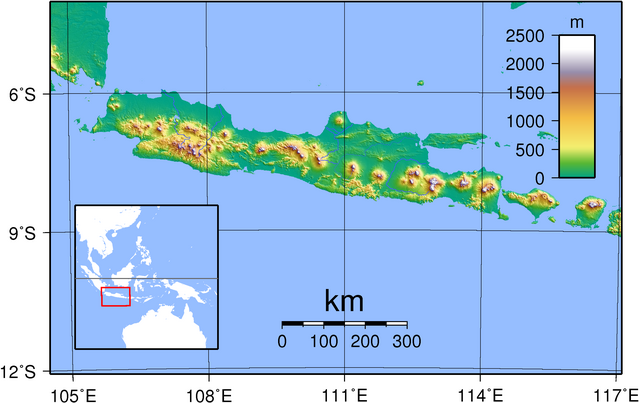
| Description | Topography of Java. Created with GMT from publicly released SRTM data. For locator version, see Image:Java Locator Topography.png |
| Date | |
| Source | Own work |
| Author | Sadalmelik |
Licensing
| I, the copyright holder of this work, release this work into the public domain. This applies worldwide. In some countries this may not be legally possible; if so: I grant anyone the right to use this work for any purpose, without any conditions, unless such conditions are required by law. |
File history
Click on a date/time to view the file as it appeared at that time.
| Date/Time | Thumbnail | Dimensions | User | Comment | |
|---|---|---|---|---|---|
| current | 13:45, 30 August 2007 | | 2,688 × 1,693 (1.16 MB) | imagescommonswiki>Sadalmelik | {{Information |Description=Topography of Java. Created with GMT from publicly released SRTM data. |Source=self-made |Date=30 Aug, 2007 |Author= Sadalmelik }} Category:Maps of Indonesia Category:Topographic maps of Asia |
File usage
The following file is a duplicate of this file (more details):
- File:Java Topography.png from Wikimedia Commons
The following page uses this file:

