File:Lakes of Africa.jpg
From HandWiki
Size of this preview: 595 × 600 pixels. Other resolutions: 476 × 480 pixels | 4,261 × 4,296 pixels.
Original file (4,261 × 4,296 pixels, file size: 7.42 MB, MIME type: image/jpeg)
Summary
| Description |
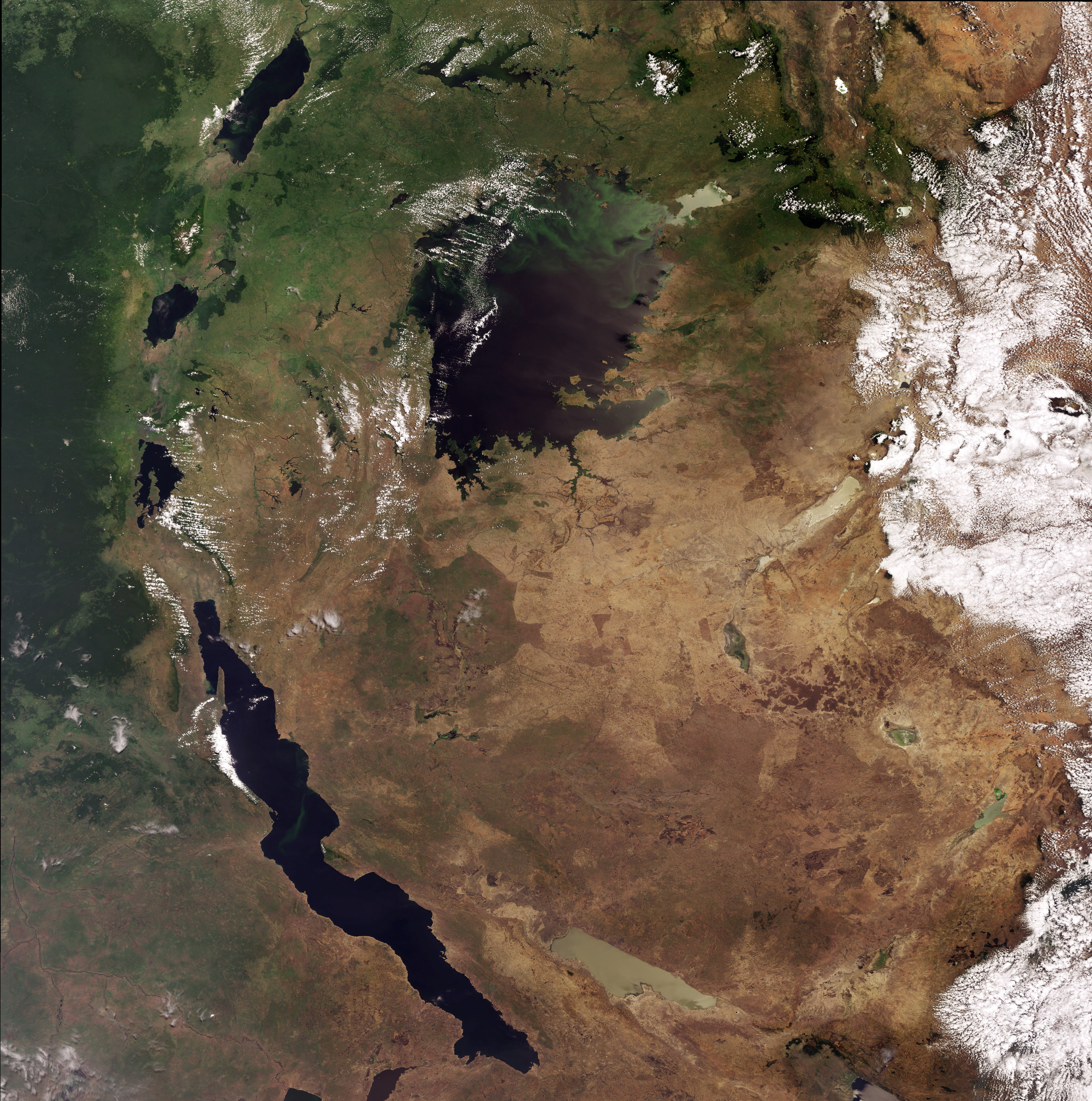
English: This Envisat image highlights lakes in the Western Rift of the Great Rift Valley, a geological fault system of Southwest Asia and East Africa: Lake Victoria, visible in the top centre, Kyoga, the lake above Victoria, Tanganyika, the oblong-shaped lake visible in the bottom left, Lake Albert, visible in the top left, Lake Edward, beneath Albert and Lake Kivu, beneath Edward. This image was acquired by Envisat's Medium Resolution Imaging Spectrometer (MERIS) on 6 October 2008, working in Full Resolution Mode providing a spatial resolution of 300 m. |
| Date | |
| Source | http://www.esa.int/spaceinimages/Images/2008/10/Lakes_of_Africa |
| Author | European Space Agency |
| Permission (Reusing this file) |
ESA,CC BY-SA 3.0 IGO |
| Other versions |
|
| Title | Lakes of Africa |
| Keywords | Water (fresh); Lakes |
| Set | Earth observation image of the week |
| Mission | Envisat |
| Activity | Observing the Earth |

Licensing
This file is licensed under the Creative Commons Attribution-ShareAlike 3.0 IGO license.
Attribution: ESA
- You are free:
- to share – to copy, distribute and transmit the work
- to remix – to adapt the work
- Under the following conditions:
- attribution – You must give appropriate credit, provide a link to the license, and indicate if changes were made. You may do so in any reasonable manner, but not in any way that suggests the licensor endorses you or your use.
- share alike – If you remix, transform, or build upon the material, you must distribute your contributions under the same or compatible license as the original.
File history
Click on a date/time to view the file as it appeared at that time.
| Date/Time | Thumbnail | Dimensions | User | Comment | |
|---|---|---|---|---|---|
| current | 00:25, 2 March 2017 | | 4,261 × 4,296 (7.42 MB) | imagescommonswiki>Revent | =={{int:filedesc}}== {{Photograph |photographer = Envisat satellite |title = Lakes of Africa |description = {{en|1=This Envisat image highlights lakes in the Western Rift of the Great Rift Valley, a geological fault system... |
File usage
The following file is a duplicate of this file (more details):
- File:Lakes of Africa.jpg from Wikimedia Commons
The following page uses this file:

