File:Maas Delta1.jpg
From HandWiki
Size of this preview: 387 × 600 pixels. Other resolution: 616 × 955 pixels.
Original file (616 × 955 pixels, file size: 221 KB, MIME type: image/jpeg)
Summary
| Description |
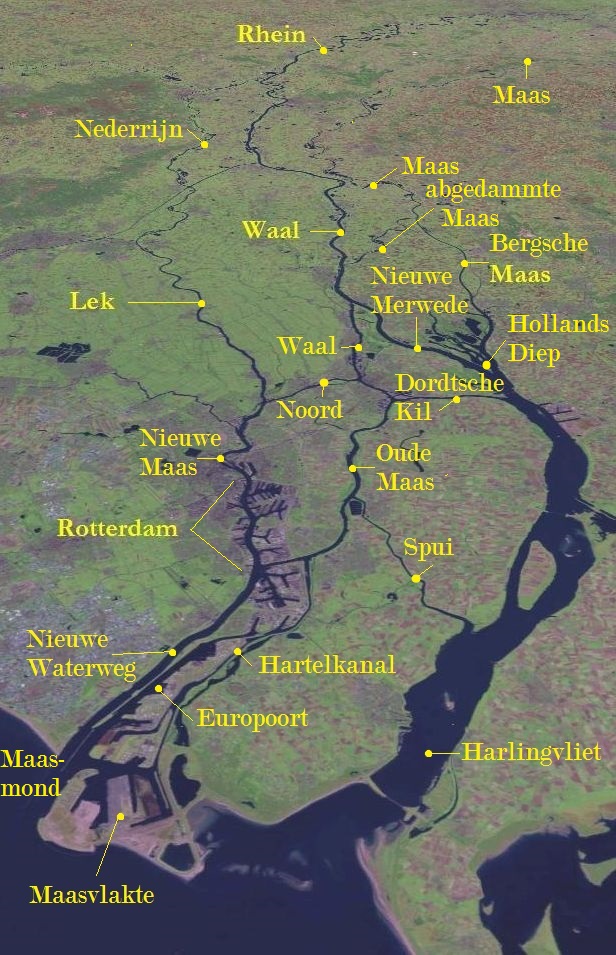
Deutsch: Rhein-Maas-Delta |
| Date | |
| Source | This image is in the public domain because it is a screenshot from NASA World Wind screenshot. and is public domain. Dieser Screenshot wurde von mir um die Namen der wesentlichen Flüsse des Deltas ergänzt. Basiert auf Bildvorlage: File:Rivieren 4.46933E 51.88083N.jpg. |
| Author | NASA World Wind, annotations by L.1951a |
Licensing
| This image is in the public domain because it is a screenshot from NASA’s globe software World Wind using a public domain layer, such as Blue Marble, MODIS, Landsat, SRTM, USGS or GLOBE.
|
 |
das Image ist public domain und auch von mir freigeggeben.
Original upload log
Transferred from de.wikipedia to Commons by Andrei Stroe using CommonsHelper.
The original description page was here. All following user names refer to de.wikipedia.
- 2008-11-02 08:00 L.1951a 1280×958× (197700 bytes) {{Information |Beschreibung = Rhein/Maas Delta |Quelle = Auf Basis :This image is in the public domain because it is a screenshot from NASA’s globe software World Wind using Blue Marble, Landsat or USGS layer, all of which are in public domain, ergänzt
- 2008-11-01 17:25 L.1951a 1280×958× (197896 bytes) {{Information |Beschreibung = Rhein/Maas Delta |Quelle = Auf Basis :This image is in the public domain because it is a screenshot from NASA’s globe software World Wind using Blue Marble, Landsat or USGS layer, all of which are in public domain ergänzt
File history
Click on a date/time to view the file as it appeared at that time.
| Date/Time | Thumbnail | Dimensions | User | Comment | |
|---|---|---|---|---|---|
| current | 08:06, 2 October 2021 | | 616 × 955 (221 KB) | imagescommonswiki>Erledigt | zusätzliche Beschriftungen |
File usage
The following file is a duplicate of this file (more details):
- File:Maas Delta1.jpg from Wikimedia Commons
The following page uses this file:

