File:Malosmadulu Atolls, Maldives.jpg
Original file (1,687 × 3,000 pixels, file size: 877 KB, MIME type: image/jpeg)
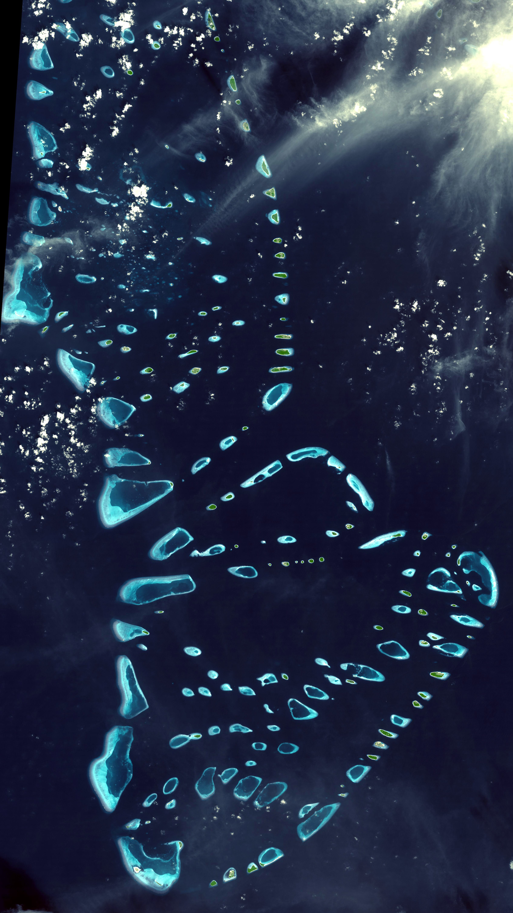
North and South Maalhosmadulu Atolls are in the Maldives, an island republic in the northern Indian Ocean, southwest of India. Maldives is made up of a chain of 1192 small coral islands that are grouped into clusters of atolls. It has a total area of 298 sq km and a population of about 330,000. The capital and largest city is Malé, with a population of about 80,000. Arguably the lowest-lying country in the world, the average elevation is 1 m above sea level. Waves triggered by the great tsunami of December 2004 spilled over sea walls to flood Malé with sand-clouded water and then swept out just as suddenly. Residents fear this was a foreboding of disasters to come from sea-level rise due to global warming. The simulated natural color ASTER image was acquired 22 December 2002, covers an area of 50.8 x 90.4 km, and is centered near 5.3 degrees north latitude, 73.9 degrees west longitude.
Please give credit for these images to: NASA/GSFC/METI/ERSDAC/JAROS, and U.S./Japan ASTER Science Team
| This file is in the public domain in the United States because it was solely created by NASA. NASA copyright policy states that "NASA material is not protected by copyright unless noted". (See Template:PD-USGov, NASA copyright policy page or JPL Image Use Policy.) | ||
 |
Warnings:
|
.jpg)
File history
Click on a date/time to view the file as it appeared at that time.
| Date/Time | Thumbnail | Dimensions | User | Comment | |
|---|---|---|---|---|---|
| current | 10:34, 25 October 2005 | | 1,687 × 3,000 (877 KB) | imagescommonswiki>Brian0918 | North and South Malosmadulu Atolls are in the Maldives, an island republic in the northern Indian Ocean, southwest of India. Maldives is made up of a chain of 1192 small coral islands that are grouped into clusters of atolls. It has a total area of 298 sq |
File usage
The following file is a duplicate of this file (more details):
- File:Malosmadulu Atolls, Maldives.jpg from Wikimedia Commons
The following page uses this file:

