File:Mapa rozsiedlenia ludności polskiej z uwzględnieniem spisów z 1916 roku.jpg
From HandWiki

Size of this preview: 659 × 599 pixels. Other resolutions: 528 × 480 pixels | 11,656 × 10,601 pixels.
Original file (11,656 × 10,601 pixels, file size: 21.5 MB, MIME type: image/jpeg)
| Warning | The original file is very high-resolution. It might not load properly or could cause your browser to freeze when opened at full size. |
|---|
Summary
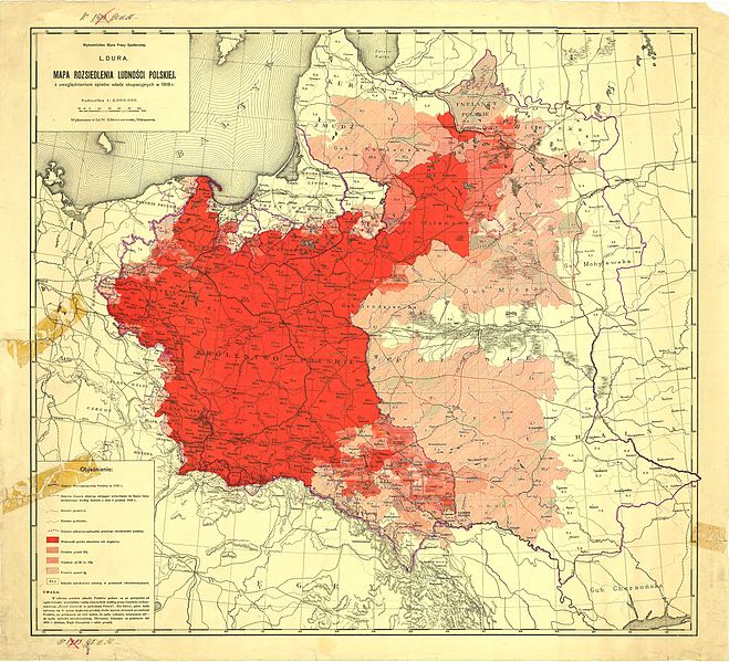
| Description |
Polski: „Mapa rozsiedlenia ludności polskiej z uwzględnieniem spisów władz okupacyjnych w 1916 r.” opracowana w Biurze Pracy Społecznej pod redakcją L. Dury, wydana przez zakład litograficzny W.Główczewskiego w Warszawie. English: Map of Polish nationality resident population censuses including the German occupation authorities in 1916, developed Office of Social Work edited by L. Dury, published by W. Glowczewski lithographic plant in Warsaw. |
| Date | after 1918 |
| Source | Wydawnictwo litograficzne W. Główczewskiego w Warszawie |
| Author | Biuro Pracy Społecznej pod redakcją L. Dury |
Licensing
|
This work is in the public domain in its country of origin and other countries and areas where the copyright term is the author's life plus 70 years or fewer. | |
| This file has been identified as being free of known restrictions under copyright law, including all related and neighboring rights. | |
File history
Click on a date/time to view the file as it appeared at that time.
| Date/Time | Thumbnail | Dimensions | User | Comment | |
|---|---|---|---|---|---|
| current | 09:54, 15 October 2011 | | 11,656 × 10,601 (21.5 MB) | imagescommonswiki>Bornholm |
File usage
The following file is a duplicate of this file (more details):
- File:Mapa rozsiedlenia ludności polskiej z uwzględnieniem spisów z 1916 roku.jpg from Wikimedia Commons
The following page uses this file:

