File:Matanuska-Susitna Borough, Alaska 2.jpg
Original file (5,534 × 2,222 pixels, file size: 7.8 MB, MIME type: image/jpeg)
This file is from a shared repository and may be used by other projects. The description on its file description page there is shown below.
Summary
DescriptionMatanuska-Susitna Borough, Alaska 2.jpg |
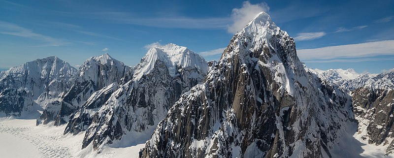
English: From back to front, Mount Church, Mount Johnson, Mount Wake and Mount Bradley |
Date | |
Source | Flickr |
Author | Ross Fowler from Sydney, Australia |
|
Camera location | 62° 56′ 11.49″ N, 150° 42′ 07.2″ W | View this and other nearby images on: OpenStreetMap | 62.936525; -150.702000 |
---|
Licensing
- You are free:
- to share – to copy, distribute and transmit the work
- to remix – to adapt the work
- Under the following conditions:
- attribution – You must give appropriate credit, provide a link to the license, and indicate if changes were made. You may do so in any reasonable manner, but not in any way that suggests the licensor endorses you or your use.
This image was originally posted to Flickr by Ross Fowler at https://flickr.com/photos/31971780@N03/14308058707. It was reviewed on 6 August 2015 by FlickreviewR and was confirmed to be licensed under the terms of the cc-by-2.0. |
6 August 2015
Annotations InfoField | This image is annotated: View the annotations at Commons |
Mount Church
Annotations InfoField | This image is annotated: View the annotations at Commons |
Mount Bradley
Mount Johnson with Mt. Grosvenor behind
Mt. Wake
Mount Bradley
747 Pass
some value
62°56'11.490"N, 150°42'7.200"W
3 June 2014
0.0015625 second
16 millimetre
100
image/jpeg
File history
Click on a date/time to view the file as it appeared at that time.
Date/Time | Thumbnail | Dimensions | User | Comment | |
---|---|---|---|---|---|
current | 06:37, 6 August 2015 | 5,534 × 2,222 (7.8 MB) | imagescommonswiki>Wilfredor | Transferred from Flickr via Flickr2Commons |
File usage
The following file is a duplicate of this file (more details):
- File:Matanuska-Susitna Borough, Alaska 2.jpg from Wikimedia Commons
The following 4 pages use this file:
Metadata
This file contains additional information, probably added from the digital camera or scanner used to create or digitize it.
If the file has been modified from its original state, some details may not fully reflect the modified file.
Camera manufacturer | SONY |
---|---|
Camera model | SLT-A99V |
Exposure time | 1/640 sec (0.0015625) |
F Number | f/8 |
ISO speed rating | 100 |
Date and time of data generation | 11:28, 3 June 2014 |
Lens focal length | 16 mm |
Latitude | 62° 56′ 11.49″ N |
Longitude | 150° 42′ 7.2″ W |
Altitude | 2,348.8 meters above sea level |
Horizontal resolution | 300 dpi |
Vertical resolution | 300 dpi |
Software used | Adobe Photoshop Lightroom 5.5 (Macintosh) |
File change date and time | 13:52, 24 June 2014 |
Exposure Program | Shutter priority |
Exif version | 2.3 |
Date and time of digitizing | 11:28, 3 June 2014 |
APEX shutter speed | 9.321928 |
APEX aperture | 6 |
APEX brightness | 11.13046875 |
APEX exposure bias | 0 |
Maximum land aperture | 2.96875 APEX (f/2.8) |
Metering mode | Spot |
Light source | Unknown |
Flash | Flash did not fire, compulsory flash suppression |
Color space | sRGB |
Focal plane X resolution | 1,677.41796875 |
Focal plane Y resolution | 1,677.41796875 |
Focal plane resolution unit | 3 |
File source | Digital still camera |
Scene type | A directly photographed image |
Custom image processing | Normal process |
Exposure mode | Auto exposure |
White balance | Auto white balance |
Digital zoom ratio | 1 |
Focal length in 35 mm film | 16 mm |
Scene capture type | Standard |
Contrast | Normal |
Saturation | Normal |
Sharpness | Normal |
GPS time (atomic clock) | 19:28 |
Receiver status | Measurement in progress |
Measurement mode | 3-dimensional measurement |
Measurement precision | Excellent (1.5116) |
Speed unit | Kilometers per hour |
Speed of GPS receiver | 254.85 |
Reference for direction of movement | True direction |
Direction of movement | 97.32 |
Geodetic survey data used | WGS-84 |
GPS date | 3 June 2014 |
GPS differential correction | 0 |
GPS tag version | 0.0.3.2 |
Lens used | 16-35mm F2.8 ZA SSM |
Label | Blue |
Date metadata was last modified | 23:52, 24 June 2014 |
Unique ID of original document | B1982887E86210730143CBDD208C6AF2 |
Keywords |
|
Province or state shown | Alaska |
Country shown | United States |
IIM version | 4 |