File:Meridiani surface hematite map.jpg
From HandWiki
Size of this preview: 800 × 533 pixels. Other resolutions: 640 × 427 pixels | 2,000 × 1,333 pixels.
Original file (2,000 × 1,333 pixels, file size: 2.18 MB, MIME type: image/jpeg)
Summary
| Description |
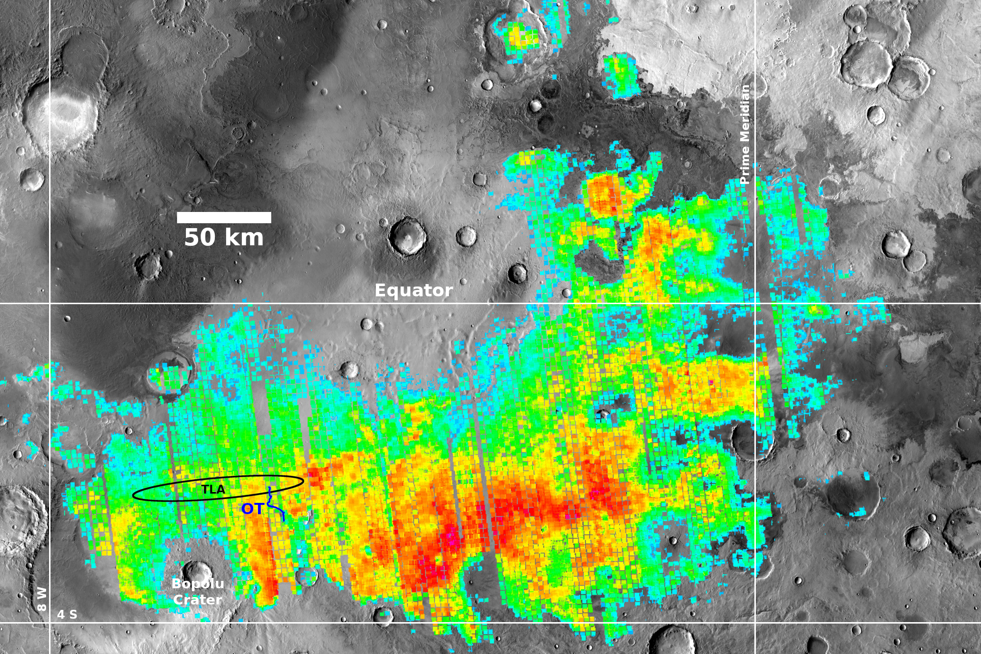
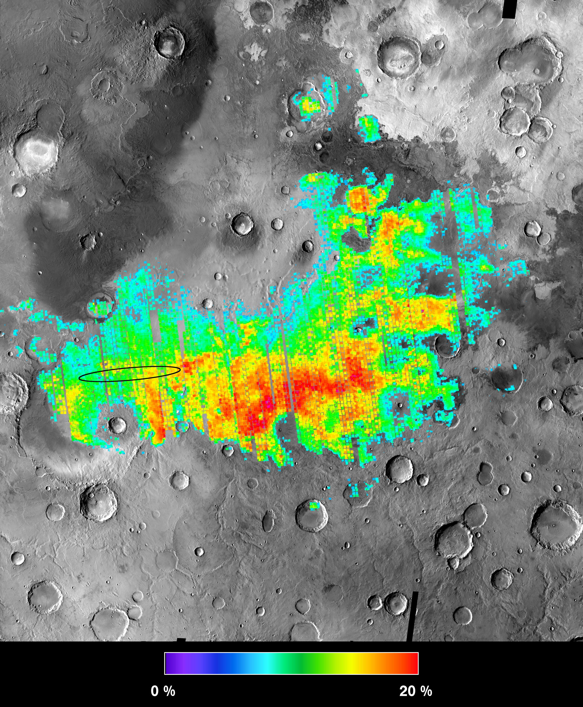
English: Map of surface hematite levels at the Meridiani Planum, overlaid over an image map of the surrounding regions. The hematite level data was collected by the thermal emission spectrometer (TES) on board the orbiting Mars Global Surveyor. This map includes lines of latitude and longitude (including the equator and prime meridian) to place it on Mars, as well as (i) an ellipse (labelled TLA) indicating the target landing area for landing the rover Opportunity, (ii) blue line (labelled OT) indicating the traverse route of the rover Opportunity, and (iii) a label for the large Bopolu Crater (in the south west). |
| Date | |
| Source | https://themis.mars.asu.edu/files/meridiani_hematite_orig_0.jpg |
| Author | Joshua Bandfield, Steven Ruff, Phil Christensen and the MGS TES team |
Licensing
| This file is in the public domain in the United States because it was solely created by NASA. NASA copyright policy states that "NASA material is not protected by copyright unless noted". (See Template:PD-USGov, NASA copyright policy page or JPL Image Use Policy.) | ||
 |
Warnings:
|
File history
Click on a date/time to view the file as it appeared at that time.
| Date/Time | Thumbnail | Dimensions | User | Comment | |
|---|---|---|---|---|---|
| current | 12:17, 16 July 2022 | | 2,000 × 1,333 (2.18 MB) | imagescommonswiki>RolfMilesOlsen | Uploaded a work by Joshua Bandfield, Steven Ruff, Phil Christensen and the MGS TES team from https://themis.mars.asu.edu/files/meridiani_hematite_orig_0.jpg with UploadWizard |
File usage
The following file is a duplicate of this file (more details):
- File:Meridiani surface hematite map.jpg from Wikimedia Commons
The following 2 pages use this file:

