File:Montenegro Map.png

Original file (2,427 × 1,807 pixels, file size: 1.03 MB, MIME type: image/png)
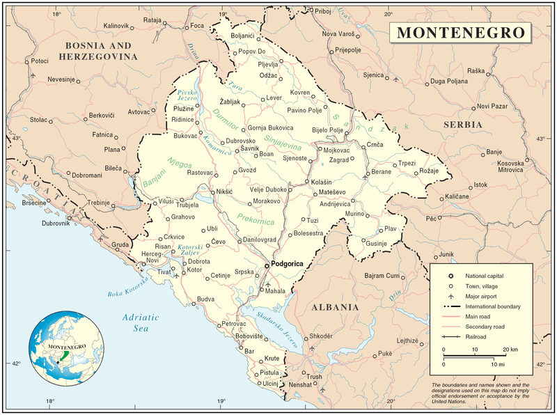
Map of Montenegro
| Description | Map of Montenegro | |||
| Date | ||||
| Source | The Cartographic Section of the United Nations (CSUN) | |||
| Author | Cartographer of the United Nations | |||
| Permission (Reusing this file) |
|

File history
Click on a date/time to view the file as it appeared at that time.
| Date/Time | Thumbnail | Dimensions | User | Comment | |
|---|---|---|---|---|---|
| current | 12:03, 10 March 2007 | | 2,427 × 1,807 (1.03 MB) | imagescommonswiki>Minestrone | Map of Montenegro {{Information |Description=Map of Montenegro |Source=The Cartographic Section of the United Nations (CSUN) |Date=2007-03-10 |Author=Cartographer of the United Nations |Permission={{Template:UN map}} and the cartographer of the UN [ |
File usage
The following file is a duplicate of this file (more details):
- File:Montenegro Map.png from Wikimedia Commons
The following page uses this file:

