File:NPS national-park-American-Samoa-visitor-center-area-map.jpg
From HandWiki

Size of this preview: 800 × 449 pixels. Other resolutions: 640 × 359 pixels | 1,952 × 1,096 pixels.
Original file (1,952 × 1,096 pixels, file size: 305 KB, MIME type: image/jpeg)
Summary
| Description |
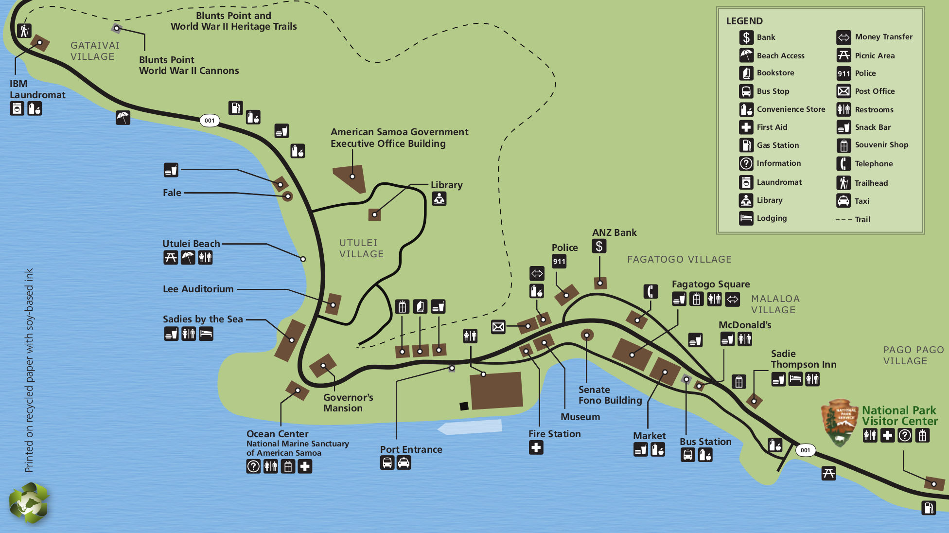
English: Zoomed-in map of American Samoa, focusing on beaches, lodging, food, and visitor services around the visitor center near Pago Pago on Tutuila Island. |
| Date | |
| Source | U.S. National Park Service (http://npmaps.com/wp-content/uploads/national-park-amercan-samoa-visitor-center-area-map.jpg) |
| Author | U.S. National Park Service, restoration/cleanup by Matt Holly |
Licensing
| This image or media file contains material based on a work of a National Park Service employee, created as part of that person's official duties. As a work of the U.S. federal government, such work is in the public domain in the United States. See the NPS website and NPS copyright policy for more information. |
File history
Click on a date/time to view the file as it appeared at that time.
| Date/Time | Thumbnail | Dimensions | User | Comment | |
|---|---|---|---|---|---|
| current | 13:35, 13 May 2017 | | 1,952 × 1,096 (305 KB) | imagescommonswiki>RKBot | =={{int:filedesc}}== {{Information |description= {{en|1=Zoomed-in map of American Samoa, focusing on beaches, lodging, food, and visitor services around the visitor center near Pago Pago on Tutuila Island.}} |date= 2016-02-22 |source= U.S. National Par... |
File usage
The following file is a duplicate of this file (more details):
- File:NPS national-park-American-Samoa-visitor-center-area-map.jpg from Wikimedia Commons
The following page uses this file:

