File:Olosega Village Aerial NPS.jpg
From HandWiki

Size of this preview: 800 × 600 pixels. Other resolutions: 640 × 480 pixels | 2,272 × 1,704 pixels.
Original file (2,272 × 1,704 pixels, file size: 480 KB, MIME type: image/jpeg)
Summary
| Description |
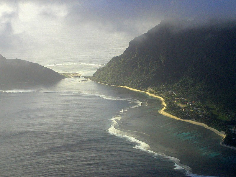
English: Aerial view of Ofu-Olosega, American Samoa. Olosega with Olosega Village on the right, Ofu on the left. Both islands are connected via bridge, crossing a narrow strait. |
| Date | not specified |
| Source | NP of American Samoa - Photo Gallery |
| Author | Peter Craig, National Park Service |
Licensing
| This image or media file contains material based on a work of a National Park Service employee, created as part of that person's official duties. As a work of the U.S. federal government, such work is in the public domain in the United States. See the NPS website and NPS copyright policy for more information. |
File history
Click on a date/time to view the file as it appeared at that time.
| Date/Time | Thumbnail | Dimensions | User | Comment | |
|---|---|---|---|---|---|
| current | 06:17, 30 April 2010 | | 2,272 × 1,704 (480 KB) | imagescommonswiki>Telim tor | == {{int:filedesc}} == {{Information |Description= {{en|Aerial view of Ofu-Olosega, American Samoa. Olosega with Olosega Village on the right, Ofu on the left. Both islands are connected via bridge, crossing a narrow strait.}} |Source=[http://www.nps.gov/ |
File usage
The following file is a duplicate of this file (more details):
- File:Olosega Village Aerial NPS.jpg from Wikimedia Commons
The following page uses this file:

