File:Road network around the Pueblo Alto community.png
From HandWiki

Size of this preview: 800 × 576 pixels. Other resolutions: 640 × 461 pixels | 1,234 × 889 pixels.
Original file (1,234 × 889 pixels, file size: 238 KB, MIME type: image/png)
Summary
| Description |
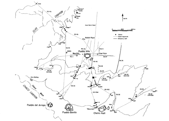
English: A National Park Service map of the road network around the Pueblo Alto community. |
| Date | |
| Source | Culture and Ecology of Chaco Canyon and the San Juan Basin. Publications in Archeology 18H, Chaco Canyon Studies. National Park Service, Santa Fe, 2005, by Mathien, Frances Joan; page 153. |
| Author | National Park Service |
Licensing
| This image or media file contains material based on a work of a National Park Service employee, created as part of that person's official duties. As a work of the U.S. federal government, such work is in the public domain in the United States. See the NPS website and NPS copyright policy for more information. |
File history
Click on a date/time to view the file as it appeared at that time.
| Date/Time | Thumbnail | Dimensions | User | Comment | |
|---|---|---|---|---|---|
| current | 14:11, 20 May 2015 | | 1,234 × 889 (238 KB) | imagescommonswiki>Rationalobserver | User created page with UploadWizard |
File usage
The following file is a duplicate of this file (more details):
- File:Road network around the Pueblo Alto community.png from Wikimedia Commons
The following 2 pages use this file:

