File:Saint Helena-CIA WFB Map.png
From HandWiki
Size of this preview: 280 × 598 pixels. Other resolution: 331 × 707 pixels.
Original file (331 × 707 pixels, file size: 5 KB, MIME type: image/png)
Summary
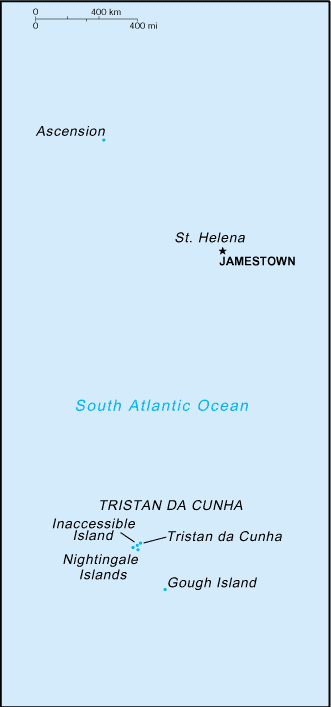
Español: Mapa de la dependencia de Santa Helena
Slovene version: Image:Saint Helena-CIA WFB Map-sl.png
This image is in the public domain because it contains materials that originally came from the United States Central Intelligence Agency's World Factbook.
|
 |
File history
Click on a date/time to view the file as it appeared at that time.
| Date/Time | Thumbnail | Dimensions | User | Comment | |
|---|---|---|---|---|---|
| current | 01:40, 14 November 2010 | | 331 × 707 (5 KB) | imagescommonswiki>Hoshie | Reverted to version as of 09:17, 27 March 2005: a newer map is at Image:Saint Helena, Ascension, and Tristan da Cunha-CIA WFB Map.png |
File usage
The following file is a duplicate of this file (more details):
- File:Saint Helena-CIA WFB Map.png from Wikimedia Commons
The following 2 pages use this file:

