File:Space syntax - Global Integration - Brasilia.png
From HandWiki

Size of this preview: 551 × 600 pixels. Other resolutions: 441 × 480 pixels | 856 × 932 pixels.
Original file (856 × 932 pixels, file size: 115 KB, MIME type: image/png)
Summary
| Description |
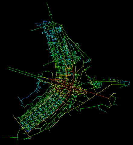
English: Map of axis lines in the city of Brasilia. The ramp of colors shows the global integration of the different streets, measuring the accessibility of a topological line for the entire system according to the spatial analysis of the syntax space. Created with Mindwalk 1.0
Español: Mapa de ejes axiales de la ciudad de Brasilia. La rampa de colores -de rojo a azul- recoge la mayor o menor integración global de las diferentes calles, midiendo la accesibilidad topológica de una línea para todo el conjunto del sistema según el análisis espacial de la sintaxis del espacio. Creado con Minwalk 1.0 |
| Date | |
| Source | Own work |
| Author | Tony Rotondas |
| Other versions |
 |
Licensing
| I, the copyright holder of this work, release this work into the public domain. This applies worldwide. In some countries this may not be legally possible; if so: I grant anyone the right to use this work for any purpose, without any conditions, unless such conditions are required by law. |
File history
Click on a date/time to view the file as it appeared at that time.
| Date/Time | Thumbnail | Dimensions | User | Comment | |
|---|---|---|---|---|---|
| current | 07:08, 8 December 2008 | | 856 × 932 (115 KB) | imagescommonswiki>Tony Rotondas | {{Information |Description={{en|1=Map of axis lines in the city of Brasilia. The ramp of colors shows the global integration of the different streets, measuring the accessibility of a topological line for the entire system according to the spatial analysi |
File usage
The following file is a duplicate of this file (more details):
- File:Space syntax - Global Integration - Brasilia.png from Wikimedia Commons
The following page uses this file:

