File:Verbreitungsgebiet der Tataren.PNG
From HandWiki
Size of this preview: 800 × 285 pixels. Other resolution: 1,077 × 384 pixels.
Original file (1,077 × 384 pixels, file size: 13 KB, MIME type: image/png)

|
This ethnographic map image could be re-created using vector graphics as an SVG file. This has several advantages; see Commons:Media for cleanup for more information. If an SVG form of this image is available, please upload it and afterwards replace this template with
{{vector version available|new image name}}.
It is recommended to name the SVG file “Verbreitungsgebiet der Tataren.svg”—then the template Vector version available (or Vva) does not need the new image name parameter. |
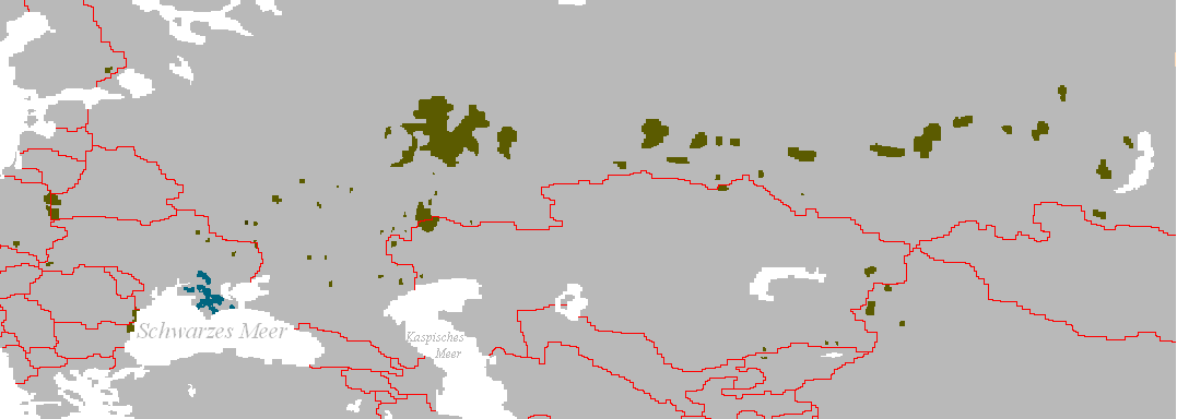
Verbreitungsgebiet der Turko-Tataren
- Beschreibung: Darstellungskarte mit den Siedlungsgebieten jener Völker, die sich heute als „Tataren“ bezeichnen bzw. sich von diesen herführen.
- Zeichner: Postmann Michael
- erstellt am: 13. Februar 2005
| |
This work has been released into the public domain by its author, Postmann Michael, at the English Wikipedia project. This applies worldwide. In case this is not legally possible: |
File history
Click on a date/time to view the file as it appeared at that time.
| Date/Time | Thumbnail | Dimensions | User | Comment | |
|---|---|---|---|---|---|
| current | 10:56, 3 June 2024 | 1,077 × 384 (13 KB) | imagescommonswiki>Sakaiberian | Reverted to version as of 08:36, 10 July 2017 (UTC) |
File usage
The following file is a duplicate of this file (more details):
- File:Verbreitungsgebiet der Tataren.PNG from Wikimedia Commons
The following page uses this file:

