File:WindRiverBasinStratigraphy.png
From HandWiki
Size of this preview: 744 × 600 pixels. Other resolutions: 596 × 480 pixels | 927 × 747 pixels.
Original file (927 × 747 pixels, file size: 145 KB, MIME type: image/png)
Summary
| Description |
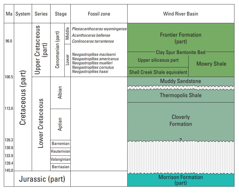
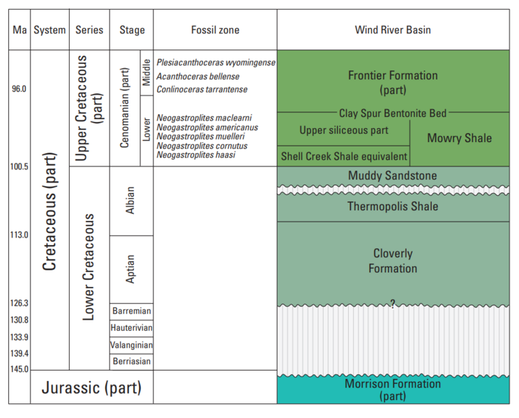
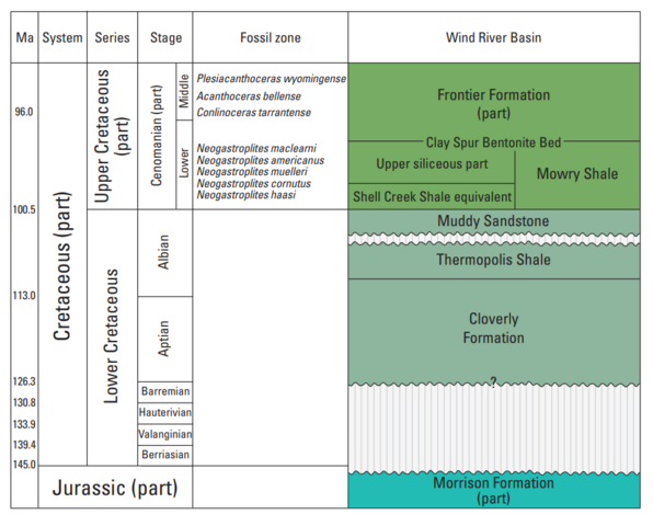
English: Wind River Basin Stratigraphy |
| Date | |
| Source | Stratigraphic Cross Sections of the Mowry Shale and Associated Strata in the Wind River Basin, Wyoming, USGS, https://pubs.usgs.gov/sim/3476/sim3476_pamphlet.pdf |
| Author | Thomas M. Finn |
Licensing
This image is in the public domain in the United States because it only contains materials that originally came from the United States Geological Survey, an agency of the United States Department of the Interior. For more information, see the official USGS copyright policy.
|
File history
Click on a date/time to view the file as it appeared at that time.
| Date/Time | Thumbnail | Dimensions | User | Comment | |
|---|---|---|---|---|---|
| current | 12:31, 20 July 2023 | | 927 × 747 (145 KB) | imagescommonswiki>Pi3.124 | Uploaded a work by Thomas M. Finn from Stratigraphic Cross Sections of the Mowry Shale and Associated Strata in the Wind River Basin, Wyoming, USGS, https://pubs.usgs.gov/sim/3476/sim3476_pamphlet.pdf with UploadWizard |
File usage
The following file is a duplicate of this file (more details):
- File:WindRiverBasinStratigraphy.png from Wikimedia Commons
The following page uses this file:

