Search results
From HandWiki
- River. The embayment is a topographically low-lying basin that is filled with Cretaceous to recent sediments. The northern end of the embayment appears as6 KB (709 words) - 10:20, 5 February 2024
- possibly caused the underlying rocks to sink down, creating the embayment. The shore of the embayment lay inland at the present-day Fall Line in the region. Throughout3 KB (294 words) - 17:15, 2 November 2022
File:Mississippi Embayment Structural Map.png Submitted to commons.wikimedia.org This file is licensed under the Attribution-Share Alike 3.0 Unported (CC BY-SA 3.0) license. You are free: to share(682 × 568 (107 KB)) - 21:38, 3 October 2022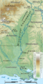
File:Mississippi Embayment relief map 2.svg Submitted to commons.wikimedia.org This file is licensed under the Attribution-Share Alike 3.0 Unported (CC BY-SA 3.0) license. You are free: to share(474 × 914 (8.97 MB)) - 01:39, 7 October 2022
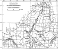
File:Mississippi Embayment Top Cretaceous Contour Map.png Submitted to commons.wikimedia.org This file is licensed under the Attribution-Share Alike 3.0 Unported (CC BY-SA 3.0) license. You are free: to share(1,079 × 900 (805 KB)) - 08:22, 3 October 2022


