Earth:Mount Harcourt
From HandWiki
Revision as of 08:36, 18 August 2022 by imported>Wincert (over-write)
Short description: Volcano in Victoria Land, Antarctica
| Mount Harcourt | |
|---|---|
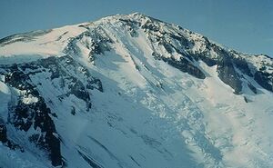
 Mount Harcourt, 1964 photo | |
| Highest point | |
| Elevation | 5,153 ft (1,571 m) [1] |
| Coordinates | [ ⚑ ] : 72°18′S 170°00′E / 72.3°S 170°E [1] |
| Geography | |
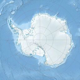
Hallett Peninsula, Antarctica | |
| Geology | |
| Age of rock | Oldest dated rock: 5.5 and 6.6 million years[1] |
| Mountain type | Stratovolcano[1] |
| Volcanic arc/belt | Hallett Peninsula |
Mount Harcourt is a stratovolcano making up part of the Hallett Peninsula extending into the Ross Sea about 375 mi (604 km) south of Mount Erebus, along with three overlapping shield volcanoes. It was discovered and named by the Nimrod expedition in December 1908.[2]
Two dates have been obtained from the volcano's rock, roughly 5.5 and 6.6 million years in age. These samples are alkalic in composition.[1] The volcano is known to be a site of Boscoia sudpolaris.[3]
See also
- List of volcanoes in Antarctica
References
- ↑ 1.0 1.1 1.2 1.3 1.4 "Mount Harcourt, Victorialand, Antarctica". http://volcano.oregonstate.edu/vwdocs/volc_images/antarctica/harcourt.html. Retrieved 23 July 2010.
- ↑ Mount Harcourt, New Zealand Gazetteer, https://gazetteer.linz.govt.nz/place/12904, retrieved 2019-04-02
- ↑ Entomology of Antarctica. J. Linsley Gressitt (Editor). Accessed 23-7-10


