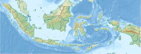
Earth:Merangin Geopark
| Merangin Geopark | |
|---|---|
| Location | Merangin Regency, Jambi, Indonesia |
| Nearest city | Jambi city |
| Coordinates | [ ⚑ ] 2°22′24″S 101°52′26″E / 2.373374°S 101.874025°E[1] |
| Area | 20,360 square kilometer |
| Established | 2013 |
Merangin Geopark is a national Geopark at Merangin Regency, Jambi, in the island of Sumatra, Indonesia.The geopark has Araucarioxylon fossil tree complete with the root of 300 million years, the oldest in Asia.[2] It is being proposed to become member of Global Geopark Network (GGN) to be recognized UNESCO by 2017. It takes about six hours journey from Jambi City to reach the park.
Description
The Geopark has a land area of 20,360 square kilometer.[3]It is estimated to be 300 million years old. Merangin Geopark site is the world's oldest plates of earth's fragments, similar and even about the same age as the rocks that exist in historic sites in China. Therefore, the place became the main field of research of the world's geologists in studying the evolution of the earth. There are lots of fossil plants, ranging from nail plants, dikotil, monokotil ,shellfish, insects and others, printed petrified in the rock sediment lava and volcanic ash of ancient mountains. The fossils in Merangin are scattered along the Batang Merangin and Mengkarang Rivers. The fossils are also present in the soil.
Merangin Geopark is divided into four parts. Namely, Paleobotani Park Merangin, Highland Park Kerinci, Geo-Cultural Park Sarolangun, and Godwana Park Bukit. Paleobotani Park Merangin is divided into three zones. Namely, the catchment zone, the core geo-conservation zone, bio-conservation, cultural conservation and buffer zone which is the area along the watershed (DAS).
Paleobotani Park Merangin is 1,551 square kilometers divided into two zones. The first zone is called geo-conservation which is divided into two blocks. Namely, Jambi Flora area which includes the Village of Water Batu to Biuku Tanjung Village and Kars Sengayau area in Manau River and Kars Jangkat. Kars Sengayau area has 13 caves. The second zone is called bio-conservation. Namely, protected forest areas and customary forests in Merangin. One of them, Customary Forest in Guguk Village, Renah Pembarap District. Guguk Forest has an area of about 690 hectares.
Attraction
The old rocks that lie along the river, the fossils of plants and trees on the banks of the river, making it a natural tourist attraction and exotic history tour.Swift rivers are also a rafting location. Several times this location is used as a place of international rafting competition.Merangin Geopark has attracted many foreign researchers coming, from Europe, America, Malaysia and Japan.[4]
See also
- List of National Geoparks
References
- ↑ Coordinates from wikidata
- ↑ "Warga Jepang Buru Batuan Purba Geopark". http://jambi.tribunnews.com/2014/11/20/warga-jepang-buru-batuan-purba-geopark. Retrieved December 6, 2017.
- ↑ "Geopark Berusia 300 Juta Tahun Terancam Penambang Emas Liar Rakus". http://regional.liputan6.com/read/2821674/geopark-berusia-300-juta-tahun-terancam-penambang-emas-liar-rakus. Retrieved 6 December 2017.
- ↑ "Keindahan Geopark dan Fosil 350 Juta Tahun di Merangin". http://jambi.tribunnews.com/2015/10/10/keindahan-geopark-dan-fosil-350-juta-tahun-di-merangin. Retrieved 6 December 2017.


