Earth:Tsho Rolpa
From HandWiki
Revision as of 21:36, 24 September 2021 by imported>John Stpola (url)
| Tsho Rolpa | |
|---|---|
| Cho Rolpa | |
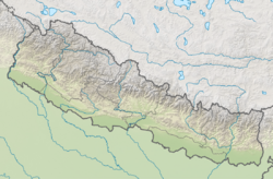
| Location | Rolwaling Valley, Dolakha District,[1] Nepal |
| Coordinates | [ ⚑ ] : 27°52′N 86°28′E / 27.867°N 86.467°E |
| Type | glacial lake |
| Max. length | 3.45 kilometres (2.14 mi)[1] |
| Max. width | 0.5 kilometres (0.31 mi)[1] |
| Surface area | 1.537 square kilometres (0.593 sq mi)[1] |
| Average depth | 55 metres (180 ft) |
| Max. depth | 270 metres (890 ft) |
| Water volume | 85,940,000 cubic metres (3.035×10⁹ cu ft)[1] |
| Surface elevation | 4,580 metres (15,030 ft) |
Tsho Rolpa (also Cho Rolpa) is one of the biggest glacial lakes in Nepal. The lake, which is located at an altitude of 4,580 metres (15,030 ft) in the Rolwaling Valley, Dolakha District, has grown considerably over the last 50 years due to glacial melting in the Himalayas.[2][1]
Flooding
The lake threatens to burst through its unstable dam, which would threaten the lives and livestock of over 6000 villagers living around the Tamakoshi River.[2][3] In 2012, the UNDP reported that an early warning system installed by the authorities in the late 1990s, which became defunct through lack of maintenance, will be replaced by a more modern warning system for glacial floods from the lake.[4][3]
References
- ↑ 1.0 1.1 1.2 1.3 1.4 1.5 Shrestha, Badri Bhakta; Nakagawa, Hajime (March 2014), "Assessment of potential outburst floods from the Tsho Rolpa glacial lake in Nepal", Natural Hazards (Dordrecht: Springer Science) 71 (1): 913–936, doi:10.1007/s11069-013-0940-3, ISSN 0921-030X
- ↑ 2.0 2.1 Melting Himalayan Glaciers May Doom Towns National Geographic 7 May 2002, retrieved on 21 November 2010
- ↑ 3.0 3.1 Tsho Rolpa to get early warning system The Himalayan Times 23 May 2012, accessed 9 January 2013
- ↑ Chho-Rolpa warning sirens lying defunct The Himalayan Times 13 June 2010, accessed 21 November 2010


