Earth:Mount Ningadhun
From HandWiki
Short description: Mountain in New South Wales, Australia
| Mount Ningadhun | |
|---|---|
| Castle Rock, Ningadoon (Hunt), Ningadhun[1] | |
 | |
| Highest point | |
| Elevation | 1,373 m (4,505 ft) [2] |
| Coordinates | [ ⚑ ] : 30°17′17″S 150°04′12″E / 30.28806°S 150.07°E [1] |
| Geography | |
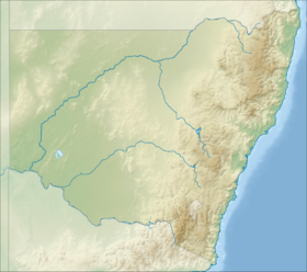
North West Slopes, New South Wales, Australia | |
| Parent range | Nandewar Range |
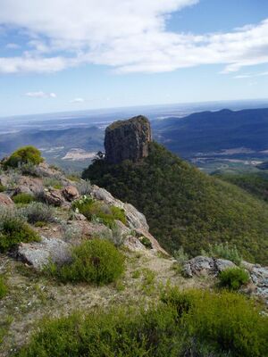
Mount Ningadhun, also known as Castle Rock, Ningadoon (Hunt), and Ningadhun,[1] is a mountain on the Nandewar Range, a spur off the Great Dividing Range, is located in the North West Slopes region of New South Wales, Australia . Mount Ningadhun is situated east of Narrabri, within the Mount Kaputar National Park
With an elevation of 1,373 metres (4,505 ft) above sea level, Mount Ningadhun is a prominent volcanic plug and part of the remnants of the Nandewar extinct volcano that ceased activity about 17 million years ago after 4 million years of activity.[3]
See also
- List of mountains in New South Wales
References
- ↑ 1.0 1.1 1.2 Template:NSW GNR
- ↑ "Map of Mount Ningadhun, NSW". Bonzle Digital Atlas of Australia. http://www.bonzle.com.au/c/a?a=p&p=37141&cmd=sp.
- ↑ Hutton, Geoffrey (1983). Australia's Natural Heritage (2nd ed.). Collins ISBN:0-00-217297-6
 |


