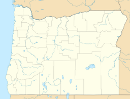
Earth:China Hat (Oregon)
| China Hat | |
|---|---|
| Highest point | |
| Elevation | 6,573 |
| Coordinates | [ ⚑ ] : 43°40′51″N 121°02′02″W / 43.680874°N 121.033844°W |
| Geography | |
| Location | Deschutes, Oregon, United States |
| Parent range | Cascade Range |
| Topo map | USGS China Hat |
| Geology | |
| Age of rock | 6.3 - 7.4 Ma[1] |
| Mountain type | Pyroclastic cone |
| Volcanic arc | Cascade Volcanic Arc |
| Last eruption | Pleistocene |
China Hat is a volcanic butte on the southeastern flank of Newberry Volcano in Deschutes County, Oregon, United States . It is a rhyolitic dome dating from the age of the Middle Pleistocene.[2] Both China Hat and nearby East Butte are covered by Mazama Ash and Newberry Ash.[3]
Although China Hat is often thought of as a side vent of Newberry Volcano less than ten miles away,[4] it is estimated to be older than first formation of the Newberry Caldera, 780,000 thousand years old [5] versus 500,000 years ago [6] and is on the western edge of a series of high lava plains eruptions derived from a tongue of the same mantle plume that fuels the Yellowstone Caldera[7]
China Hat Road, named after the butte, starts in Bend and heads to Fort Rock.[8] The road is a hotspot for law enforcement.[8] China Hat Campground is a campground located near China Hat butte along this road.[9]
The butte was named for its similarity in appearance, when viewed from Fort Rock, to the Asian conical hat worn by Chinese immigrant laborers.[8]
References
- ↑ "Bimodal volcanism of the High Lava Plains and Northwestern Basin and Range of Oregon : Distribution and tectonic implications of age-progressive rhyolites". https://ir.library.oregonstate.edu/downloads/p8418q022. Retrieved 2018-01-04.
- ↑ "Newberry Volcano; The Life and Times of a Shield Volcano Complex (Field Trip 3A)". http://intheplaygroundofgiants.com/field-guides-to-central-oregons-geology/field-guide-to-the-newberry-volcano-and-christmas-valley-fort-rock-area/newberry-volcano-the-life-and-times-of-a-shield-volcano-complex-field-trip-3a/. Retrieved 2018-01-03.
- ↑ U.S. Geological Survey (1969). "Geological Survey Research 1969 Chapter D". https://books.google.com/books?id=pIbfZGpuorIC&q=%22china+hat%22+butte+geology+oregon+-idaho&pg=PP39. Retrieved 2018-01-03.
- ↑ Jensen, Robert A. Roadside Guide to the Geology of Newberry Crater. Third edition. Bend, OR: CenOreGeoPub 2000
- ↑ Harris, Stephen L. Fire Mountains of the West. Third edition. Missoula, MT: Mountain Press Publishing 2005
- ↑ Jensen, page 24
- ↑ Orr, Elizabeth L. and William N. Oregon Geology. Corvallis, OR: Oregon State University Press 2012 page 115
- ↑ Jump up to: 8.0 8.1 8.2 "Road, butte named after the accessory worn by Chinese immigrant laborers". http://www.bendbulletin.com/news/1460817-151/road-butte-named-after-the-accessory-worn-by. Retrieved 2018-01-03.
- ↑ "China Hat Campground". https://www.fs.usda.gov/recarea/deschutes/recreation/camping-cabins/recarea/?recid=39280&actid=29. Retrieved 2018-01-03.
 |


