Earth:SITPA-IDEAS
SITPA-IDEAS (Territorial Information System and Spatial Data Infrastructure of the Principality of Asturias; in Spanish, Sistema de Información Territorial e Infraestructura de Datos Espaciales del Principado de Asturias) is a Spatial Data Infrastructure and geoportal where all kinds of geographic information of interest of Principality of Asturias are made available.[1] Its coordination, management and maintenance is the responsibility of General Directorate of Territorial Planning, through the Cartography Service, in collaboration with the different departments of the Government of Principality of Asturias, who either share the geographic information they generate, or work together with the Service, in order to generate new geographic information.[1]
History
SITPA (Territorial Information System of the Principality of Asturias) was started in 2000 by the Government of Principality of Asturias, in order to make available to the public the geographic information it had, because it was considered of great interest, not only for its own specific tasks, but also for other applications.[1]
Some years later, after Directive 2007/2/EC of the European Parliament and of the Council of March 14, 2007 establishing an infrastructure for spatial information in the European Community (INSPIRE), and its transposition into the Spanish regulatory framework through Law 14/2010, of July 5, on geographic information infrastructures and services in Spain (LISIGE) (which required Public Administrations to provide geographic information services such as cartography visualization and reuse of public geographic information, either through interoperability services, or by direct download), SITPA evolved to incorporate the Spatial Data Infrastructure of Asturias, since then being renamed SITPA - IDEAS.
The integration between SITPA territorial information system and IDEAS spatial data infrastructure has been kept and highlighted in the new version of the SITPA-IDEAS geoportal, launched in 2020.
Available contents
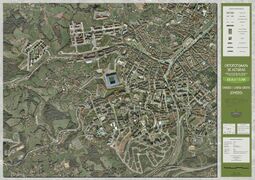
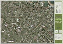
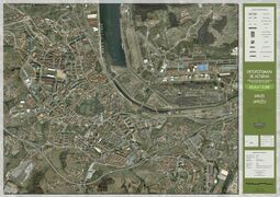
It has a download center[2], from which it is possible to download a basic cartography (topographic maps of Principality of Asturias at 1:5000 and 1:10000 scale, as well as other maps at different scales), aerial images from different years (in addition to a series of orthophotomaps of the main Asturian towns, published in 2010), historical and thematic cartography, territorial studies, and urban approach.
It also has a map viewer[3], a metadata catalog[4], and a series of Web Services[5] (among them, Web Map Service).
License
Its contents are published under the terms of the Creative Commons-Attribution (CC-by 4.0) license.[6]
Gallery
- Orthophotomaps of Oviedo
- Orthophotomaps of Gijón
- Orthophotomap of Avilés
References
- ↑ 1.0 1.1 1.2 "SITPA-IDEAS". https://ideas.asturias.es/sitpa-ideas.
- ↑ "Download center - SITPA - IDEAS" (in es). https://ideas.asturias.es/centro-de-descargas.
- ↑ "SITPA-IDEAS map viewer" (in es). https://sigvisor.asturias.es/SITPA/?webmap=e0dded03df464437acca9632c5c4fae7&locale=es.
- ↑ "Metadata catalog - SITPA - IDEAS" (in es). https://ideas.asturias.es/catalogo-de-metadatos.
- ↑ "SITPA - IDEAS - Web Services" (in es). https://ideas.asturias.es/servicios-web.
- ↑ "Frequently Asked Questions - SITPA - IDEAS" (in es). https://ideas.asturias.es/preguntas-frecuentes.
External links


