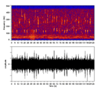
Earth:GLORIA sidescan sonar
From HandWiki
Revision as of 02:43, 15 December 2020 by imported>WikiGary (update)
Short description: Geological Long Range Inclined Asdic for determining the topography of the ocean floor
The GLORIA sidescan sonar is a side-scan sonar system for determining the topography of the ocean floor. GLORIA stands for Geological Long Range Inclined Asdic.[1]
Like most side-scan sonars, the GLORIA instrument is towed behind a ship. GLORIA has a ping rate of two per minute, and detects returns from a range of up to 22 km either side of the sonar fish.
References
External links
U.S. Geological Survey GLORIA Mapping Program


