Place:Nelson, New Zealand
Nelson Whakatū (Māori) | |
|---|---|
City | |
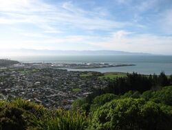 View of Nelson from the "Centre of New Zealand" in November 2006 | |
| Nickname(s): Top of the South, Sunny Nelson | |
| Motto(s): Latin: Palmam qui meruit ferat (Let him, who has earned it, bear the palm) | |
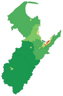
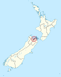 Nelson Region in New Zealand | |
| Coordinates: [ ⚑ ] : 41°16′15″S 173°17′2″E / 41.27083°S 173.28389°E | |
| Country | New Zealand |
| Unitary authority | Nelson City |
| Settled by Europeans | 1841 |
| Founded by | Arthur Wakefield |
| Named for | Horatio Nelson |
| Electorates | Nelson Te Tai Tonga |
| Suburbs | List
|
| Government | |
| • Mayor | Nick Smith |
| • Deputy mayor | Rohan O'Neill-Stevens |
| • MPs | Rachel Boyack (Labour) Tākuta Ferris (Te Pāti Māori) |
| Area | |
| • Territorial | 422.19 km2 (163.01 sq mi) |
| • Urban | 54.33 km2 (20.98 sq mi) |
| Population (June 2021)[1] | |
| • Territorial | 54,700 |
| • Density | 130/km2 (340/sq mi) |
| • Urban | 51,100 |
| • Urban density | 940/km2 (2,400/sq mi) |
| Time zone | UTC+12 (NZST) |
| • Summer (DST) | UTC+13 (NZDT) |
| Postcode | 7010, 7011, 7020 |
| Area code(s) | 03 |
| HDI (2021) | 0.927[2] very high · 7th |
| Website | {{{1}}} |
Nelson (Māori: Whakatū) is a New Zealand city on the eastern shores of Tasman Bay at the top of the South Island. It is the oldest city in the South Island and the second-oldest settled city in New Zealand; it was established in 1841 and became a city by royal charter in 1858.[3]
Nelson City is bordered to the west and south-west by the Tasman District and to the north-east, east and south-east by the Marlborough District. The Nelson urban area has a population of 51,100,[1] making it New Zealand's 15th most populous urban area.
Nelson is well known for its thriving local arts and crafts scene; each year, the city hosts events popular with locals and tourists alike, such as the Nelson Arts Festival.[4]
Etymology
Nelson was named in honour of Admiral Horatio Nelson, who defeated both the French and Spanish fleets at the Battle of Trafalgar in 1805. Many roads and public areas around the city are named after people and ships associated with that battle. Inhabitants of the city are referred to as Nelsonians; Trafalgar Street is its main shopping axis.
Nelson's Māori name, Whakatū,[5] means 'construct', 'raise', or 'establish'.[6]
In an article to The Colonist newspaper on 16 July 1867, Francis Stevens described Nelson as "The Naples of the Southern Hemisphere".[7] Today, Nelson has the nicknames of "Sunny Nelson" due to its high sunshine hours per year or the "Top of the South" because of its geographic location.
In New Zealand Sign Language, the name is signed by putting the index and middle fingers together which are raised to the nose until the fingertips touch the nose, then move the hand forward so that the fingers point slightly forward away from oneself.[8]
History
Early settlement
Settlement of Nelson began about 700 years ago by Māori.[9] There is evidence that the earliest settlements in New Zealand were around the Nelson-Marlborough regions. Some of the earliest recorded iwi in the Nelson district are Ngāti Hāwea, Ngāti Wairangi, Waitaha and Kāti Māmoe.[10] Waitaha people developed the land around the Waimea Gardens, are believed to have been the first people to quarry argillite in around Nelson. They also developed much of the Waimea Gardens complex – more than 400 hectares on the Waimea Plains near Nelson.[11] In the early 1600s, Ngāti Tūmatakōkiri displaced other te Tau Ihu Māori, becoming the dominant tribe in the area until the early 1800s.[10] Raids from northern tribes in the 1820s, led by Te Rauparaha and his Ngāti Toa, soon decimated the local population and quickly displaced them.
Today there are eight mutually recognised tribes of the northernwestern region: Ngāti Kuia, Ngāti Apa ki te Rā Tō, Rangitāne, Ngāti Toarangatira, Ngāti Koata, Ngāti Rārua, Ngāti Tama and Te Atiawa o Te Waka-a-Māui.[10]
Historic places
Isel House is a local historical building located in Nelson. It was home to one of Nelson's first families, the Marsdens. Many of the rooms have been transformed into displays for the public to view. The restoration of Isel House is managed by Isel House Charitable trust under the supervision of Sally Papps, but the house and the park ground surrounding it are owned by the Nelson City Council.[12]
Founders Heritage Park is a local historical visit in Nelson. This interactive park shows visitors the history of Nelson, New Zealand. The park is set up as a village filled with buildings set in a historical time, including well established gardens. Throughout the park, there are stories to be learned about the history of this town.[13]
New Zealand Company
Planning
The New Zealand Company in London planned the settlement of Nelson. They intended to buy from the Māori some 200,000 acres (810 km2) of land, which they planned to divide into one thousand lots and sell to intending settlers. The company earmarked profits to finance the free passage of artisans and labourers, with their families, and for the construction of public works. However, by September 1841 only about one third of the lots had sold. Despite this, the colony pushed ahead, and land was surveyed by Frederick Tuckett.[14]
Three ships, the Arrow, Whitby, and Will Watch, sailed from London commanded by Captain Arthur Wakefield. Arriving in New Zealand, they discovered that the new Governor of the colony, William Hobson, would not give them a free hand to secure vast areas of land from the Māori or indeed to decide where to site the colony. However, after some delay, Hobson allowed the Company to investigate the Tasman Bay area at the north end of the South Island. The Company selected the site now occupied by Nelson City because it had the best harbour in the area. But it had a major drawback: it lacked suitable arable land; Nelson City stands right on the edge of a mountain range while the nearby Waimea Plains amount to only about 60,000 acres (240 km2), less than one third of the area required by the Company plans.
The Company secured land from the Māori, that was not clearly defined, for £800: it included Nelson, Waimea, Motueka, Riwaka and Whakapuaka. This allowed the settlement to begin, but the lack of definition would prove the source of much future conflict. The three colony ships sailed into Nelson Haven during the first week of November 1841. When the four first immigrant ships – Fifeshire, Mary-Ann, Lord Auckland and Lloyds – arrived three months later, they found the town already laid out with streets, some wooden houses, tents and rough sheds. The town was laid out on a grid plan.[15] Within 18 months, the Company had sent out 18 ships with 1052 men, 872 women and 1384 children. However, fewer than ninety of the settlers had the capital to start as landowners.
Cultural and religious immigrants
The early settlement of Nelson province included a proportion of German immigrants, who arrived on the ship Sankt Pauli and formed the nucleus of the villages of Sarau (Upper Moutere) and Neudorf. These were mostly Lutheran Protestants with a small number of Bavarian Catholics.[16]
In 1892, the New Zealand Church Mission Society (NZCMS) was formed in a Nelson church hall.[17]
Churches In Nelson, New Zealand:
– Destiny Church Nelson
– Baptist Church Richmond
– Living Faith Church
– The Salvation Army
– Anglican Church
– Holy Family Parish Nelson/Stoke
– Dial-A-Prayer
– Aspire church
– Richmond New Life Church
– Presbyterian – St luke's Union
– NZ Anglican Church Pension Board
– Nelson Spiritualist Church SCNZ
– Grace Communion International
– Quakers Religious Society of Friends
– Richmond Church of Christ
– Old St Peters
– Cathedral Church Wardens
– Seventh Day Adventist Church
– Church of Christ Parkers Road (Nondenomiational)[18]
Problems with land
After a brief initial period of prosperity, the lack of land and of capital caught up with the settlement and it entered a prolonged period of relative depression. The labourers had to accept a cut in their wages. Organised immigration ceased (a state of affairs that continued until the 1850s). By the end of 1843, artisans and labourers began leaving Nelson; by 1846, some 25% of the immigrants had moved away.
The pressure to find more arable land became intense. To the south-east of Nelson lay the wide and fertile plains of the Wairau Valley. The New Zealand Company tried to claim that they had purchased the land. The Māori owners stated adamantly that the Wairau Valley had not formed part of the original land sale, and made it clear they would resist any attempts by the settlers to occupy the area. The Nelson settlers led by Arthur Wakefield and Henry Thompson attempted to do just that. This resulted in the Wairau Affray, where 22 settlers and 4 Māori died.[19] The subsequent Government inquiry exonerated the Māori and found that the Nelson settlers had no legitimate claim to any land outside Tasman Bay.[20] Public fears of a Māori attack on Nelson led to the formation of the Nelson Battalion of Militia in 1845.
City
Nelson township was managed by the Nelson Provincial Council through a Board of Works constituted by the Provincial Government under the Nelson Improvement Act 1856 until 1874. It was proclaimed a Bishop's See and city under letters patent by Queen Victoria on 27 September 1858,[21] the second New Zealand city proclaimed in this manner after Christchurch. Nelson only had some 5,000 residents at this time. Edmund Hobhouse[22] was the first Bishop. The Municipal Corporations Act 1876 stated that Nelson was constituted a city on 30 March 1874.
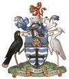
Coat of arms
Nelson City has a coat of arms, obtained in 1958 from the College of Arms to mark the Centenary of Nelson as a City. The blazon of the arms is:
- "Barry wavy Argent and Azure a Cross Flory Sable on a Chief also Azure a Mitre proper And for the Crest on a Wreath of the Colours Issuant from a Mural Crown proper a Lion rampant Gules holding between the fore paws a Sun in splendour or. The supporters on the dexter side a Huia Bird and on the sinister side a Kotuku both proper."
Motto "Palmam qui meruit ferat" (Let him, who has earned it, bear the palm). This motto is the same as that of Lord Nelson.
Nelson Province
From 1853 until 1876, when provincial governments were abolished, Nelson was the capital of Nelson Province. The province itself was much larger than present-day Nelson City and included all of the present-day Buller, Kaikōura, Marlborough, Nelson, and Tasman, as well as the Grey District north of the Grey River and the Hurunui District north of the Hurunui River. The Marlborough Province split from Nelson Province in October 1859.
Nelson provincial anniversary
Nelson Anniversary Day is a public holiday observed in the northern half of the South Island of New Zealand, being the area's provincial anniversary day. It is observed throughout the historic Nelson Province, even though the provinces of New Zealand were abolished in 1876. The modern area of observation includes all of Nelson City and includes all of the present-day Buller, Kaikōura, Marlborough, Tasman districts as well as the Grey District north of the Grey River / Māwheranui and the Hurunui District north of the Hurunui River. The holiday usually falls on the Monday closest to 1 February, the anniversary of the arrival of the first New Zealand Company boat, the Fifeshire on 1 February 1842.[23]
Anniversary celebrations in the early years featured a sailing regatta, horse racing, running races, shooting and ploughing matches. In 1892, the Nelson Jubilee Celebration featured an official week-long programme with church services, sports, concerts, a ball and a grand display of fireworks.
Time gun
In 1858, the Nelson Provincial Council erected a time gun at the spot on Brittania Heights where, in 1841, Captain Wakefield erected his flagpole. The gun was fired each Saturday at noon to give the correct time. The gun is now preserved as a historical relic and the Songer Tree[24] marks the site on Signal Hill of the original flagpole.[25]
Geography
The Nelson-Tasman area comprises two unitary authorities – Nelson City, administered by the Nelson City Council, and Tasman District, administered by the Tasman District Council, based in Richmond 15 kilometres (9 miles) to the southwest. It is between Marlborough, another unitary authority, to the east, and the West Coast Regional Council to the west.
For some while,[when?] there has been talk about amalgamating Nelson City and the Tasman District to streamline and render more financially economical the existing co-operation between the two councils,[26][27][28] exemplified by the jointly owned Port Nelson and the creation of Nelson Tasman Tourism, a jointly owned tourism promotion organisation.[29]
However, an official poll conducted in April 2012 showed nearly three-quarters of those who voted in Richmond were opposed to the proposal, with a narrow majority in favour.
Nelson has beaches and a sheltered harbour. The harbour entrance is protected by a Boulder Bank, a natural, 13 km (8 miles) bank of rocks transported south from Mackay Bluff via longshore drift. The bank creates a perfect natural harbour which enticed the first settlers, although the entrance was narrow. The wreck of the Fifeshire on Arrow Rock (now called Fifeshire Rock in memory of this disaster) in 1842 proved the difficulty of the passage.[30] A cut was later made in the bank in 1906 which allowed larger vessels access to the port.
The creation of Rocks Road around the waterfront area after the Tāhunanui slump[31] in 1892 increased the effects of the tide on Nelson city's beach, Tāhunanui, and removed sediment. This meant the popular beach and adjoining car park were being eroded (plus the sand dunes) so a project to replace these sands was put in place and has so far proved a success, with the sand rising a considerable amount and the dunes continuing to grow.
Waterways
The Nelson territorial authority area is small (just 445 km2) and has four main waterways, the Whangamoa, Wakapuaka, Maitai and Roding Rivers. The Roding River, the southernmost in Nelson, arises in the hills between Mount Meares and Dun Mountain. From there it flows westward before entering the Tasman District where it eventually joins the Waimea River, which flows into Waimea Inlet near Rabbit Island. The Maitai River flows westward from the Dun Mountain area into the town centre of Nelson before entering the Nelson Haven then Tasman Bay via 'The Cut'. Major tributaries of the Maitai River are: York and Brook Streams plus Sharland, Packer, Groom, Glen, Neds, Sclanders, Beauchamp and Mill Creeks. The Wakapuaka River, which flows north from the Saddle Hill area to its mouth at Cable Bay in North Nelson, has two main tributaries, the Lud and Teal Rivers. Entering Tasman Bay near Kokorua in the north of Nelson, the Whangamoa River is the longest waterway in Nelson.
Smaller waterways in the south of Nelson include: Saxton Creek, Orchard Stream, Poorman Valley Stream, Arapiki Stream, Jenkins Creek and Maire Stream.
Central city
The central city of Nelson, also referred to as the central business district (CBD), is bounded by Halifax Street to the north, Rutherford Street to the west, Collingwood Street to the east, and Selwyn Place to the south.[32] Other major streets within the CBD include Trafalgar Street, Bridge Street and Hardy Street.
Suburbs
Suburbs within Nelson City's territorial area borders are grouped into four city districts:
|
Nelson North :
|
City Centre :
|
Tāhunanui-Port Hills[citation needed]:
|
Stoke :
|
The Nelson commuter belt extends to Richmond, Brightwater, Hope, Māpua and Wakefield in the Tasman District.[33]
National parks
Nelson is surrounded by mountains on three sides and Tasman Bay / Te Tai-o-Aorere on the fourth, with its region acting as the gateway to the Abel Tasman, Kahurangi, and Nelson Lakes National Parks.
It is a centre for both ecotourism and adventure tourism and has a high reputation among caving enthusiasts due to several prominent cave systems around Takaka Hill and the Wharepapa / Arthur Range, including the Nettlebed Cave and some of the largest and deepest explored caverns in the Southern Hemisphere.
Nelson is known for its great lakes, hikes and walks surrounding the town, the most popular being the Abel Tasman Coast Track, Abel Tasman National Park, and Heaphy Track. These tracks are also known for recreational activities. [34] There are many huts and camping grounds in all three tracks for availability to stay in. There are places to fish, hunt and observe nature within the National Parks and Lakes. [35]
Climate
Nelson has a temperate oceanic climate (Cfb), with mild winters and warm summers. Nelson has rainfall evenly distributed throughout the year and has fewer frosts due to the highly marine geography of New Zealand. Winter is the stormiest time, where gales and storms are more common. Nelson has one of the sunniest climates of all major New Zealand centres,[36] earning the nickname 'Sunny Nelson' with an annual average total of over 2400 hours of sunshine.[37] The highest recorded temperature in Nelson is 36.3 °C (97 °F), the lowest −6.6 °C (20 °F).
Script error: No such module "weather box".
"Centre of New Zealand" monument
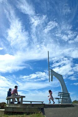
Nelson has a monument on Botanical Hill, near the centre of the city. The walk to this is called the "Centre of New Zealand walk". Despite the name, this monument does not mark the actual geographic centre of New Zealand.
Instead, the monument marks the "zero, zero" point to which the first geodetic surveys of New Zealand were referenced. These surveys were started in the 1870s by John Spence Browning, the Chief Surveyor for Nelson. From this 360-degree viewpoint, survey marks in neighbouring regions (including Wellington in the North Island) could be triangulated and the local surveys connected.[39]
In 1962, Dr Ian Reilly from the now defunct Department of Scientific and Industrial Research calculated the geographic centre of New Zealand (including Stewart Island and some smaller islands in addition to the North and South Island, but excluding the Chathams) to be in a forest in Spooners Range 35 mi (56 kilometres) southwest of Nelson at [ ⚑ ] 41°30′S 172°50′E / 41.5°S 172.833°E.[40]
Owing to the coarse nature of the underlying data (use of rectangular areas of 7.5 minutes of arc on each side), the centre calculated by Dr Reilly has quite large error margins. Recalculating the result with more modern and accurate data shows the geographic centre of New Zealand is approximately 60 km southwest of Nelson, in the Big Bush Conservation Area north of Saint Arnaud, New Zealand.[41]
Demographics
Nelson covers 422.19 km2 (163.01 sq mi)[42] and had an estimated population of 54,700 as of June 2021,[1] with a population density of 130 people per km2.
| Historical population | ||
|---|---|---|
| Year | Pop. | ±% p.a. |
| 1991 | 36,459 | — |
| 1996 | 40,278 | +2.01% |
| 2001 | 41,568 | +0.63% |
| 2006 | 42,888 | +0.63% |
| 2013 | 46,437 | +1.14% |
| 2018 | 50,880 | +1.84% |
| Source: [43][44] | ||
Nelson City had a population of 50,880 at the 2018 New Zealand census, an increase of 4,443 people (9.6%) since the 2013 census, and an increase of 7,992 people (18.6%) since the 2006 census. There were 19,821 households, comprising 24,804 males and 26,076 females, giving a sex ratio of 0.95 males per female. The median age was 43.4 years (compared with 37.4 years nationally), with 9,027 people (17.7%) aged under 15 years, 8,469 (16.6%) aged 15 to 29, 23,541 (46.3%) aged 30 to 64, and 9,843 (19.3%) aged 65 or older.
Ethnicities were 86.7% European/Pākehā, 10.7% Māori, 2.3% Pasifika, 7.1% Asian, and 2.3% other ethnicities. People may identify with more than one ethnicity.
The percentage of people born overseas was 23.6, compared with 27.1% nationally.
Although some people chose not to answer the census's question about religious affiliation, 56.2% had no religion, 31.8% were Christian, 0.3% had Māori religious beliefs, 0.9% were Hindu, 0.2% were Muslim, 1.2% were Buddhist and 2.4% had other religions.
Of those at least 15 years old, 9,150 (21.9%) people had a bachelor's or higher degree, and 7,674 (18.3%) people had no formal qualifications. The median income was $29,600, compared with $31,800 nationally. 5,634 people (13.5%) earned over $70,000 compared to 17.2% nationally. The employment status of those at least 15 was that 19,311 (46.1%) people were employed full-time, 7,119 (17.0%) were part-time, and 1,278 (3.1%) were unemployed.[43]
Economy
The Nelson economy (and that of the neighbouring Tasman District) is based on the 'big five' industries; seafood, horticulture, forestry, farming and tourism.[45] Port Nelson[46] is the biggest fishing port in Australasia. There are also a range of growth industries, including art and craft, aviation, engineering technology, and information technology. The region is sixth in terms of GDP growth in the 2007–10 period.[47]
The combined sub-national GDP of Nelson and Tasman District was estimated at $3.4 billion in 2010, 1.8% of New Zealand's national GDP.[47][48]
Nelson is home to various business agencies that serve the city and its surrounds,[49] including Nelson Tasman Tourism (NTT),[50] which aims to promote the region and help advertisers reach visitors from New Zealand and overseas,[51] and the Nelson Regional Economic Development Agency (EDA), which works to "coordinate, promote, facilitate, investigate, develop, implement, support and fund initiatives relating to economic development [and] employment growth ... within the Nelson region ..."[52][53]
Below is a list of some of the region's largest companies and employers:
- Former regional airline Air Nelson had its headquarters and maintenance base at Nelson Airport.
- Helicopters (NZ) has its headquarters and maintenance base at Nelson Airport.
- Japanese automobile manufacturer Honda has its New Zealand distribution centre in the Whakatu Industrial Estate in Stoke.
- Beverage company McCashins has a microbrewery in Stoke
- Sea Dragon Marine Oils[54] has a fish oil refinery in Annesbrook.
- The Cawthron Institute has a research facility in The Wood.
- Food manufacturer, the Talley's Group has processing facilities at Port Nelson.
- The New Zealand King Salmon Company[55] processes Chinook salmon at its factory in Annesbrook.
- Pic's Peanut Butter is made in its Stoke, New Zealand factory.
In 2013, Nelson Mayor Aldo Miccio worked on a proposal that would see Australian call centres for companies such as Gen-i and Xero relocated to Nelson. The plan was in response to Australian companies moving call and contact centres out of Asia because their Australian customers preferred English-speaking centres. If the plan was successful, Mr Miccio expected 100 to 300 jobs paying NZ$50,000-plus in the first year to be created in Nelson.[56]
Government
Local
As a unitary authority, the Nelson City Council has the combined responsibilities and functions of both a territorial (local) and regional council. This is different from most other local authorities in New Zealand. More often, a regional council is a separate organisation with several territorial authorities (city or district councils) within its borders. Other unitary authorities are the Auckland Council, Gisborne District Council, Marlborough District Council, Tasman District Council and the Chatham Islands Council.
The Nelson City Council currently holds its elections under the First Past the Post electoral system once every three years, with the most recent election held on 12 October 2019. Electors vote by indicating their choice for Mayor by placing a tick beside one of the names, and the person who receives the most votes becomes Mayor. Councillors are elected the same way, but voters could cast multiple votes, with the 12 candidates who each receive the most votes becoming Councillors. Voters in this system may vote for no more than 12 candidates. The elections are conducted by post over a three-week period to make it as convenient as possible for people to vote.
The other option permitted under the Local Electoral Act 2001, but not currently used in Nelson, is the Single Transferable Vote system. Multiple-member districts are used. Electors vote by ranking candidates in order of preference by placing a number beside candidates' names. The elector can mark a preference for one or up to the total number of candidates on the paper. The number of votes required for a candidate to be elected, the quota, depends on the number of positions to be filled and the number of valid votes. (Election of mayor may be held using the Instant-runoff vote method.)
Under the Local Electoral Act 2002, the Nelson City Council can resolve to change the electoral system to be used for the next two elections, and it must review this decision every six years. A referendum was held in 2003 to decide which electoral system would be used for the 2004 and 2007 Nelson City Council elections. The outcome was that the First Past the Post system was retained. The 2008 review retains that system for the 2010 and 2013 elections.[57]
On 12 October 2013, Rachel Reese was elected as Nelson's first woman mayor after receiving 1,500 votes more than incumbent mayor Aldo Miccio.[58]
As of 13 October 2022, the current council members for the 2022 to 2025 term are:
| Mayor | Nick Smith |
| Deputy Mayor | Rohan O'Neill-Stevens |
| Councillors | Matty Anderson Matthew Benge Trudie Brand Mel Courtney James Hodgson Kahu Paki Paki Pete Rainey Campbell Rollo Rachel Sanson Tim Skinner Aaron Stallard |
National
Nelson is covered by one general electorate: Nelson and one Māori electorate: Te Tai Tonga.
As of the 2020 general election, Nelson is held by Rachel Boyack of the Labour Party. The Māori electorate Te Tai Tonga, which covers the entire South Island and part of Wellington in the North Island, is currently held by Labour and represented by Rino Tirikatene.
Culture and the arts
As the major regional centre, the city offers many lodgings, restaurants, and unique speciality shopping such as at the Jens Hansen Goldsmiths where "The One Ring" in The Lord of the Rings film trilogy was designed.[59]
- Nelson has a vibrant local music and arts scene and is known nationwide for its culturally idiosyncratic craftsmen. These include potters, glass blowers (such as Flamedaisy Glass Design and Höglund Art Glass Studio & Gallery), and dozens of wood carvers using native New Zealand southern beech and exotic macrocarpa.
- Nelson is a popular visitor destination and year-round attracts both New Zealanders and international tourists.[60]
- The Nelson Saturday Market is a popular weekly market where one can buy direct from local artists.[61]
- The Theatre Royal was restored in 2010 and is the oldest wooden functioning theatre in the Southern Hemisphere (built 1878)[62]
- Art organisations include the Suter Art Gallery[63] and Nelson Arts Festival.[64]
- The Victory Village community received the 2010 New Zealander of the Year award for Community of the Year.[65]
The first rugby union match in New Zealand took place at the Botanic Reserve in Nelson on 14 May 1870, between the Nelson Suburbs FC and Nelson College, and an informative commemorative plaque was renovated at the western edge of the grassed area by Nelson City Council in 2006.[66]
Marae
Whakatū Marae, in the suburb of Atawhai, is the marae (meeting ground) of Ngāti Kuia, Ngāti Kōata, Ngāti Rārua, Ngāti Tama ki Te Tau Ihu, Ngāti Toa Rangatira and Te Atiawa o Te Waka-a-Māui. It includes the Kākāti wharenui (meeting house).
In October 2020, the Government committed $240,739 from the Provincial Growth Fund to restore the marae, creating an estimated 9 jobs.[67]
Events and festivals
Several major events take place:
- Nelson Jazz & Blues Festival[68] – January
- Nelson Kite Festival[69] – January
- Nelson Yacht Regatta[70] – January
- Baydreams-Nelson – January [71]
- Taste Tasman – January [72]
- Evolve Festival – January [73]
- Adam Chamber Music Festival[74] – biennial – January / February
- International Kai Festival – February [75]
- Weet-bix Kids TRYathlon – March [76]
- Evolve Festival[77] – February
- Marchfest[78] – March
- Taste Nelson festival[79] – March
- Te Ramaroa Light Festival – biennial in June/July
- Winter Music Festival[80] – July
- Nelson Arts Festival – October
- NZ Cider Festival – November [81]
- Nelson A&P Show – November [82]
More information about Events in Nelson, New Zealand can be found here. [83]
World of Wearable Art Awards
The annual World of Wearable Art Awards was founded in Nelson in 1987 by Suzie Moncrieff. The first show was held at the restored William Higgins cob cottage in Spring Grove, near Brightwater.[84][85] The show moved to Wellington in 2005 when it became too big to hold in Nelson.[84] A local museum showcased winning designs alongside their collection of classic cars until the venture was forced to close because of the COVID-19 pandemic. The classic car museum re-opened in 2020.[86][87][88]
Architecture
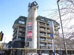
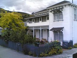
The tallest building in Nelson is the 40 m (130 feet) tall Rutherford Hotel located on the west edge of Trafalgar Square. Unlike many towns and cities in New Zealand, Nelson has retained many Victorian buildings in its historic centre and the South Street area has been designated as having heritage value.[89]
Surviving historic buildings
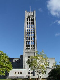
- Nelson Cathedral
- Amber House
- Broadgreen House
- Cabragh House
- Chez Eelco
- Fairfield House[90]
- Founders Park Windmill
- Isel House
- Melrose House
- Nelson Central School Renwick House
- Theatre Royal
- Victorian Rose Pub
- Redwood College (Founders Park)
- Nelson Centre of Musical Arts (formerly Nelson School of Music) Est. 1894[91]
Museums
The Nelson region houses several museums.
- The Founders Heritage Park houses a number of groups with historical themes, including transport.
- The Nelson Provincial Museum houses a collection of locally significant artefacts.
- The Nelson Classic Car Museum houses a collection of collectable cars.[92]
Parks and zoo
Nelson has a large number and variety of public parks and reserves maintained at public expense by Nelson City Council.[93] Major reserves include Grampians Reserve, close to the suburb of Braemar, and the botanical Reserve in the east of Nelson, close to The Wood.
Natureland Zoological Park is a small zoological facility close to Tāhunanui Beach. The facility is popular with children, where they can closely approach wallabies, monkeys, meerkats, llamas and alpacas, Kune Kune pigs, otters, and peacocks. There are also turtles, tropical fish and a walk through aviary.[94] Although the zoo nearly closed in 2008, the Orana Wildlife Trust took over its running instead.[95] It looked like[to whom?] a bright future ahead for Natureland and its staff, but since the repeated earthquakes in Christchurch in 2011 and the damage to Orana Park, Orana Wildlife Trust are uncertain of the future of Natureland.[96] Orana Wildlife trust have since pulled out of Natureland, which is now run independently.
Sister cities
Nelson has sister city relationships with:[97]
- Miyazu, Japan (1976)
- Huangshi, China (1996)
- Yangjiang, China (2014)
Sport
Major sports teams
| Club | Sport | Founded | League | Venue |
|---|---|---|---|---|
| Nelson Cricket Association | Cricket | 1858 | Hawke Cup | Saxton Oval |
| Nelson Giants | Basketball | 1982 | National Basketball League | Trafalgar Centre |
| Nelson Suburbs FC | Football | 1962 | Mainland Premier League Chatham Cup |
Saxton Field |
| Tasman Mako | Rugby | 2006 | Mitre 10 Cup | Trafalgar Park |
| Tasman Titans | Rugby league | 1995 | Rugby League Cup | |
| Tasman United | Football | 2015 | ISPS Handa Premiership | Trafalgar Park |
Major venues
| Image | Venue |
|---|---|

|
Saxton Oval |
| The Trafalgar Centre | |

|
Trafalgar Park |

|
Theatre Royal |
Infrastructure and services
Healthcare
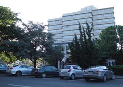
The main hospital in Nelson is the Nelson Hospital. It is the seat of the Nelson Marlborough District Health Board.
The Manuka Street Hospital is a private institution.
Law enforcement
The Nelson Central Police Station, located in St John Street, is the headquarters for the Tasman Police District.[98] The Tasman Police District has the lowest crime rate within New Zealand.[99]
Gangs
Several gangs have established themselves in Nelson. They include the now disbanded Lost Breed and the Red Devils a support club for the Hells Angels. The Rebels Motorcycle Club also has a presence in the wider Nelson-Tasman area.[100]
Electricity
The Nelson City Municipal Electricity Department (MED) established the city's public electricity supply in 1923, with electricity generated by a coal-fired power station at Wakefield Quay. The city was connected to the newly commissioned Cobb hydroelectric power station in 1944 and to the rest of the South Island grid in 1958. The grid connection saw the Wakefield Quay power station was relegated to standby duty before being decommissioned in 1964.[101][102]
Today, Nelson Electricity operates the local distribution network in the former MED area, which covers the CBD and inner suburbs, while Network Tasman operates the local distribution network in the outer suburbs (including Stoke, Tāhunanui and Atawhai) and rural areas.[101][103]
Transport
Air transport
Nelson Airport is located southwest of the city, at Annesbrook. The airport operates a single terminal and 1,347-metre (4,420 ft) runway, and in 2018 was the fifth-busiest airport in New Zealand by passenger numbers.[104] There are more than a million passenger movements using the airport terminal annually and the airport averages 90 aircraft movements every day, with a plane taking off or landing every 4.5 minutes during scheduled hours.
It is primarily used for domestic flights, with regular flights to and from Auckland, Christchurch, Hamilton, Kapiti Coast, Palmerston North and Wellington. Nelson Airport is home to Air Nelson, which operates and maintains New Zealand's largest domestic airline fleet and was also the headquarters of Origin Pacific Airways until their collapse in 2006. Sounds Air offers flights from Nelson to Wellington.
In 2006, the airport received restricted international airport status to facilitate small private jets.
In February 2018, the approach road to the airport was flooded when the adjoining Jenkins Creek burst its banks during a storm that brought king tides and strong winds. The airport was closed for about one hour.[105] In 2022, the NZ SeaRise programme identified Nelson airport as one area of particular vulnerability to sea level rise, with a projected subsidence of 5 millimetres (0.20 in) per year.[106] The airport's Chief Executive said that the proposed runway extension would be planned around the latest sea level rise forecast, and that the airport was "here to stay", despite the concerns over the threats posed by sea level rise.[106]
Maritime transport
Port Nelson is the maritime gateway for the Nelson, Tasman and Marlborough regions and a vital hub for economic activity. The following shipping companies call at Port Nelson:
- Australian National Line / CMA CGM
- Maersk Line
- Mediterranean Shipping Company
- Pacifica Shipping
- Toyofuji Shipping
- Swire Shipping
In the mid-1994, a group of local businessmen, fronted by local politician Owen Jennings proposed building a deep-water port featuring a one-kilometre-long wharf extending from the Boulder Bank into Tasman Bay, where giant ships could berth and manoeuvre with ease. Known as Port Kakariki, the $97 million project was to become the hub to ship West Coast coal to Asia, as well as handling logs, which would be barged across Tasman Bay from Mapua.[107]
In January 2010, the Western Blue Highway, a Nelson to New Plymouth ferry service, was proposed by Port Taranaki. However, to date, neither the Interislander nor Bluebridge have shown any interest in the route.[108]
Anchor Shipping and Foundry Company
The 'Anchor Shipping and Foundry Company' was formed 31 March 1901 from the earlier companies of Nathaniel Edwards & Co (1857–1880) and the Anchor Steam Shipping Company (1880–1901). The Anchor Company never departed from its original aim of providing services to the people of Nelson and the West Coast of the South Island and was never a large company; it only owned 37 ships during its history. At its peak around 1930, there were 16 vessels in the fleet. The company operated three nightly return trips per week ferry service between Nelson and Wellington and a daily freight service was maintained between the two ports in conjunction with the Pearl Kasper Shipping Company, while another service carried general cargo on a Nelson-Onehunga route. In 1974, the Anchor Company was sold and merged into the Union Company.[109]
Public transport
Nelson Motor Service Company ran the first motor bus in Nelson in 1906[110] and took over the Palace horse buses in 1907.[111]
Ebus
Ebus provides public transport services between Nelson, Richmond, Motueka and Wakefield as well as on two local routes connecting Atawhai, Nelson Hospital, The Brook and the Airport.[112]
The Late Late Bus is a weekend night transport service between Nelson and Richmond. NBus Cards were replaced by Bee Cards on 3 August 2020.[113]
InterCity provides daily bus services connecting Nelson with towns and cities around the South Island.
Taxis and shuttle vans
Taxi companies in Nelson include the following:[114]
- Nelson Bays Cabs
- Nelson City Taxis
Rail transport
Nelson is one of only five major urban areas in New Zealand without a rail connection – the others being Taupō, Rotorua, Gisborne and Queenstown.[citation needed] The Nelson Section was an isolated, 3 ft 6 in (1,067 mm) gauge, government-owned railway line between Nelson and Glenhope. It operated for 79 years between 1876 and 1955.
In 1886, a route was proposed from Nelson to the junction of the Midland Railway Company at Buller via Richmond, Waimea West, Upper Moutere, Motueka, the Motueka Valley, Tadmor and Glenhope.[115]
The only sign of rail activity in Nelson today is a short heritage operation run by the Nelson Railway Society from Founders Heritage Park using their own line between Wakefield Grove and Grove. The society has proposed future extensions of their line, possibly into or near the city centre. There have been several proposals to connect Nelson to the South Island rail network, but none have come to fruition.
Horse tramway
The Dun Mountain Railway was a horse-drawn tramway serving a mine.
Road transport
The Nelson urban area is served by Template:NZlSH, which runs in a north to southwest direction. The highway travels through the city and nearby town of Richmond, continuing southwest across the plains of the Wairoa and Motueka Rivers. Plans to construct a motorway linking North Nelson to Brightwater in the south have so far been unsuccessful. A number of studies have been undertaken since 2007 including the 2007 North Nelson to Brightwater Study,[116] the Southern Link Road Project[117] and the Arterial Traffic Study.[118] On 28 June 2013, the Nelson Mayor Aldo Miccio and Nelson MP Nick Smith jointly wrote to Transport Minister Gerry Brownlee seeking for the Southern Link to be given Road of National Significance (RoNS) status.[119]
Other significant road projects proposed over the years include a cross-city tunnel from Tāhunanui Drive to Haven Road; or from Annesbrook (or Tāhunanui) to Emano Street in Victory Square; or from Tāhunanui to Washington Valley.[107]
The passenger and freight company Newmans Coach Lines was formed in Nelson in 1879, and merged with Transport Nelson in 1972.[120]
Education
Secondary schools
- Garin College
- Nayland College
- Nelson College
- Nelson College for Girls
Tertiary institutions
Nelson hosts two tertiary education institutions, the main one being Nelson Marlborough Institute of Technology. The institute has two main campuses, one in Nelson and the other in Blenheim, in the neighbouring Marlborough region. The Institute has been providing tertiary education in the Nelson-Marlborough region for the last 100 years.[121]
Nelson also has a University of Canterbury College of Education campus which currently has an intake two out of every three years for the primary sector
Media
Broadcasting
The city is served by all major national radio and television stations, with terrestrial television (Freeview) and FM radio. Local radio stations include The Hits (formerly Radio Nelson), More FM (formerly Fifeshire FM), The Breeze, ZM (formerly The Planet 97FM) and community station Fresh FM. The city has one local television station, Mainland Television.
The Nelson Examiner was the first newspaper published in the South Island. It was established by Charles Elliott (1811–1876) in 1842, within a few weeks of New Zealand Company settlers arriving in Nelson.[122] Other early newspapers were The Colonist and the Nelson Evening Mail. Today, the Nelson Mail publishes four days a week and is owned by Stuff Ltd. The Nelson Mail also publishes the weekly community papers The Nelson Leader and The Tasman Leader. The city's largest circulating newspaper is the locally owned Nelson Weekly, which is published every Wednesday.
WildTomato was a glossy monthly lifestyle magazine, focused on the Nelson and Marlborough regions – the Top of the South Island of New Zealand. The regional magazine was launched by Murray Farquhar as a 16-page local magazine in Nelson in July 2006, but was put into liquidation in March 2021.[123]
Notable people
- Sophia Anstice – seamstress and businesswoman
- Harry Atmore – politician
- Francis Bell – politician
- George Bennett – cyclist
- Chester Borrows – politician
- Mark Bright – rugby union player
- Jeremy Brockie – footballer
- Cory Brown – footballer
- Paul Brydon – footballer
- Mel Courtney – politician
- Ryan Crotty – rugby union player
- Rod Dixon – athlete
- Frederick Richard Edmund Emmett – music dealer and colour therapist
- Dame Sister Pauline Engel – nun and educator
- Finn Fisher-Black – cyclist
- Rose Frank – photographer
- John Guy – cricket player
- Isaac Mason Hill – social reformer, servant, storekeeper and ironmonger
- Frederick Nelson Jones – inventor
- Nina Jones – painter
- Charles Littlejohn – rower
- Liam Malone – athlete
- Simon Mannering – rugby league player
- Aldo Miccio – politician
- Marjorie Naylor – artist
- Edgar Neale – politician
- Geoffrey Palmer – politician and former Prime Minister
- Nick Smith – politician
- Frank Howard Nelson Stapp – concert impresario
- Rhian Sheehan – composer and musician
- Riki van Steeden – footballer
- Mike Ward – politician
- Nate Wilbourne – environmentalist
- George William Wallace Webber – postmaster, boarding-house keeper and farmer
- Guy Williams – comedian
Panoramas
See also
- List of twin towns and sister cities in New Zealand
References
- ↑ 1.0 1.1 1.2 "Subnational population estimates (RC, SA2), by age and sex, at 30 June 1996-2021 (2021 boundaries)". Statistics New Zealand. https://nzdotstat.stats.govt.nz/wbos/Index.aspx?DataSetCode=TABLECODE7979. Retrieved 22 October 2021. (regional councils); "Subnational population estimates (TA, SA2), by age and sex, at 30 June 1996-2021 (2021 boundaries)". Statistics New Zealand. https://nzdotstat.stats.govt.nz/wbos/Index.aspx?DataSetCode=TABLECODE7980. Retrieved 22 October 2021. (territorial authorities); "Subnational population estimates (urban rural), by age and sex, at 30 June 1996-2021 (2021 boundaries)". Statistics New Zealand. https://nzdotstat.stats.govt.nz/wbos/Index.aspx?DataSetCode=TABLECODE7981. Retrieved 22 October 2021. (urban areas)
- ↑ "Sub-national HDI – Area Database – Global Data Lab". https://globaldatalab.org/shdi/table/shdi/NZL/?levels=1+4&interpolation=0&extrapolation=0.
- ↑ "Nelson City | NZHistory, New Zealand history online". https://nzhistory.govt.nz/keyword/nelson#:~:text=In%201858%20Nelson%20became%20a,increased%20and%20new%20suburbs%20developed..
- ↑ "Nelson Arts Festival". http://www.nelsonartsfestival.co.nz.
- ↑ "NZ government Māori Language Commission". http://www.tetaurawhiri.govt.nz/english/resources_e/list_placenames.shtm.[|permanent dead link|dead link}}]
- ↑ "whakatū". 2023. https://www.maoridictionary.co.nz/.
- ↑ "Papers Past – Colonist – 16 July 1867 – NELSON, COBDEN, AND WESTPORT RAILWAY". Paperspast.natlib.govt.nz. https://paperspast.natlib.govt.nz/cgi-bin/paperspast?a=d&d=TC18670716.2.10.
- ↑ "Nelson – NZSL Online". https://nzsl.vuw.ac.nz/signs/4652.
- ↑ Lowe, David J. (2008). "Polynesian settlement of New Zealand and the impacts of volcanism on early Maori society: an update". University of Waikato. http://researchcommons.waikato.ac.nz/bitstream/10289/2690/1/Lowe%202008%20Polynesian%20settlement%20guidebook.pdf.
- ↑ 10.0 10.1 10.2 Walrond, Carl (7 September 2010). "Nelson region – Māori history". Ministry for Culture and Heritage. https://teara.govt.nz/en/nelson-region/page-4. Retrieved 18 September 2021.
- ↑ Mitchell, Hillary (10 February 2015). "Te Tau Ihu". Ministry for Culture and Heritage. http://www.teara.govt.nz/en/te-tau-ihu-tribes. Retrieved 15 September 2016.
- ↑ "Historic places – Nelson City Council". http://www.nelson.govt.nz/recreation/heritage/historic-places/.
- ↑ "Kia Ora & Greetings" (in en-NZ). https://www.founderspark.co.nz/.
- ↑ Somerville, Ross. "Frederick Tuckett". Dictionary of New Zealand Biography. Ministry for Culture and Heritage. https://teara.govt.nz/en/biographies/1t108.
- ↑ Schrader, Ben (26 March 2015). "City planning – Early settlement planning". https://teara.govt.nz/en/city-planning/page-1. "The New Zealand Company settlements – including Wellington, New Plymouth and Nelson – were highly planned...All towns were laid out on a rectilinear or grid plan."
- ↑ "German Settlement in Tasman Nelson New Zealand". http://www.theprow.org.nz/society/german-settlement-in-nelson/.
- ↑ "NZCMS". http://www.nzcms.org.nz/our_mission.html.
- ↑ "Churches in Nelson Area". https://yellow.co.nz/nelson-area/churches.
- ↑ "The Wairau incident – The Wairau incident | NZHistory, New Zealand history online". https://nzhistory.govt.nz/war/wairau-incident.
- ↑ Hunt, Leigh (22 June 1844). "WAIRU MASSACRE". Nelson Examiner. https://paperspast.natlib.govt.nz/newspapers/NENZC18440622.2.11.
- ↑ "Civic symbols". Nelson City Council. http://www.nelsoncitycouncil.co.nz/civic-symbols.
- ↑ "Nelson's Landmark Cathedral". Prow. http://www.theprow.org.nz/nelson-s-landmark-cathedral/.
- ↑ "Nelson Anniversary Day". http://www.theprow.org.nz/events/nelson-anniversary-day/#.V6aVedR94_4.
- ↑ "A unique record of the Notable Trees of New Zealand". Register.notabletrees.org.nz. http://register.notabletrees.org.nz/tree/view/749.
- ↑ Jeff Newport: A Short History of the Nelson Province. Page 18.
- ↑ "News". Tasman District Council. http://tdc.govt.nz/index.php?GoldenBayCommunityBoardNews.
- ↑ Moorjani, Anita. "Tasman District Libraries". Taslib.govt.nz. http://taslib.govt.nz/index.php?SpecialCouncilMinutes,Friday2June2006.
- ↑ "Tasman District Council". Tdc.govt.nz. http://tdc.govt.nz/index.php?SpecialCouncilMinutes,Thursday15June2006.
- ↑ "Nelson City Council – About Nelson – Making Nelson the destination". http://www.nelsoncitycouncil.co.nz/aboutnelson/making_nelson_the_destination.htm.
- ↑ "Nelson – the early years". Nzine.co.nz. 3 December 1932. http://www.nzine.co.nz/features/nelson_city_history.html.
- ↑ Paul C Denton, Mike R Johnston, Soils & Foundations Ltd, Nelson (12 May 2002). "Housing Development on a Large, Active Landslide: The Tahunanui Slump Story, Nelson, New Zealand". Geo-Logic Ltd. http://geo-logic.co.nz/publications/tahunanuislump.aspx.
- ↑ "Where is Nelson?". Nelson City Council. 27 April 2011. http://www.nelsoncitycouncil.co.nz/location.
- ↑ "Functional urban areas – methodology and classification | Stats NZ". https://www.stats.govt.nz/methods/functional-urban-areas-methodology-and-classification.
- ↑ "Recreation & Leisure in Nelson – Tasman" (in en). https://www.live-work.immigration.govt.nz/choose-new-zealand/regions-cities/nelson-tasman/recreation.
- ↑ "Haere mai" (in en-nz). https://www.doc.govt.nz/.
- ↑ "Nelson sets sunshine record for rival Blenheim to envy « Science in the News « News « Royal Society of New Zealand". http://www.royalsociety.org.nz/2001/03/05/weather-summer-2/.
- ↑ "Mean Monthly Sunshine". NIWA. 28 February 2007. http://www.niwa.co.nz/education-and-training/schools/resources/climate/sunshine.
- ↑ "Climate Data and Activities". NIWA Science. 28 February 2007. http://www.niwa.co.nz/education-and-training/schools/resources/climate.
- ↑ "Nelson City Council – Centre of New Zealand Walk". http://www.nelson.govt.nz/recreation/recreation/parks-and-reserves/centre-of-nz/.
- ↑ "Clipping from Nelson Mail, 27 June 1962 edition, sourced from GNS library". https://drive.google.com/file/d/1giLDfmjydEA8HMARufmWodgdSZ1zbI9D/view.
- ↑ "Centre of NZ debate fires Up". 24 April 2019. https://www.pressreader.com/new-zealand/the-press/20190424/281629601675627.
- ↑ "ArcGIS Web Application". https://statsnz.maps.arcgis.com/apps/webappviewer/index.html?id=6f49867abe464f86ac7526552fe19787.
- ↑ 43.0 43.1 "Statistical area 1 dataset for 2018 Census". Statistics New Zealand. March 2020. Nelson City (052). https://www.stats.govt.nz/information-releases/statistical-area-1-dataset-for-2018-census-updated-march-2020. 2018 Census place summary: Nelson City
- ↑ "2001 Census: Regional summary" (in en-nz). http://archive.stats.govt.nz/Census/2001-census-data/2001-census-regional-summary.aspx.
- ↑ Nelson Regional Economic Development Agency (24 July 2014). "Nelson Regional Economic Development Strategy (REDS): Regional Prosperity". Nelson Regional Economic Development Agency. http://www.eda.co.nz/edanew/wp-content/uploads/2013/06/Regional-Prosperity-24-July-2014-FINAL-FOR-EDA-PDF-for-online.pdf.
- ↑ "Port Nelson". Port Nelson. http://www.portnelson.co.nz/.
- ↑ 47.0 47.1 "Diversity puts region on sound footing". Stuff. 2 July 2013. http://www.stuff.co.nz/nelson-mail/opinion/editorial/8868115/Diversity-puts-region-on-sound-footing.
- ↑ "Regional Gross Domestic Product". Statistics New Zealand. 2007. http://www.stats.govt.nz/reports/analytical-reports/regional-gross-domestic-product.aspx.
- ↑ "Business". Tasman. Tasman District Council. 2011. http://www.tasman.govt.nz/tasman/business/.
- ↑ "Nelson NZ". Nelson Tasman Tourism. NTT. 2011. http://www.nelsonnz.com/.
- ↑ "Advertise with us". Nelson Tasman Tourism. NTT. 2011. http://www.nelsonnz.com/advertise.with.us.
- ↑ "Nelson Regional Economic Development Agency". Business: EDA. Tasman District Council. 2011. http://www.tasman.govt.nz/tasman/business/nelson-regional-economic-development-agency-eda/.
- ↑ "home page". EDA. Nelson Regional Economic Development Agency. 2011. http://www.eda.co.nz/.
- ↑ "Fish Oils | Omega 3 | Shark Liver Oil". Seadragon. http://www.seadragon.co.nz/.
- ↑ "The New Zealand King Salmon Company Limited – the New Zealand King Salmon Company". http://kingsalmon.co.nz/index.html.
- ↑ Basham, Laura (23 March 2013). "Nelson's future: a centre for calls?". Nelson Mail. Fairfax. http://www.stuff.co.nz/nelson-mail/news/8464277/Nelsons-future-a-centre-for-calls.
- ↑ "Archived copy". http://www.nelsoncitycouncil.co.nz/assets/Our-council/Downloads/RADn1302640v8GovernanceStatementAugust201226Jul2012.pdf.
- ↑ Tracy Neal (12 October 2013). "Rachel Reese wins Nelson mayoralty – nelson-mail". Stuff. http://www.stuff.co.nz/nelson-mail/9276420/Rachel-Reese-wins-Nelson-mayoralty.
- ↑ "The Real Movie Ring". Jens Hansen Contemporary Gold and Silversmith. 12 March 2013. http://www.jenshansen.com/thering.aspx.
- ↑ "Nelson Tasman Tourism – Visitor Information". Nelsonnz.com. http://www.nelsonnz.com/.
- ↑ "Nelson Market". Nelson Market. http://www.nelsonmarket.com/.
- ↑ Template:NZHPT
- ↑ "The Suter Gallery". http://www.thesuter.org.nz/.
- ↑ "Nelson Arts Festival". http://www.nelsoncitycouncil.co.nz/artsfestival/.
- ↑ "NZ of the Year Awards, Kiwibank New Zealander of the Year, Coca-Cola Amatil Young New Zealander of the Year, Ryman Healthcare S > Community of the Year". http://www.nzawards.org.nz/CommunityoftheYear/tabid/27942/Default.aspx.
- ↑ "New Zealand's First Game of Rugby". theprow.org. http://www.theprow.org.nz/events/new-zealand-first-game-of-rugby/#.WBDpsOMrKVM.
- ↑ "Marae Announcements" (Excel). Provincial Growth Fund. 9 October 2020. https://www.growregions.govt.nz/assets/funding-announcements/marae-announcements.xlsx.
- ↑ "Nelson Jazz Fest". Nelson Jazz Fest. http://www.nelsonjazzfest.co.nz/.
- ↑ "22nd Annual Nelson Kite Festival – It's On". Itson.co.nz. 20 January 2013. http://www.itson.co.nz/2013/4754-22nd-annual-nelson-kite-festival.
- ↑ "Home". Nelson Regatta. 23 January 2013. http://www.nelsonregatta.co.nz/.
- ↑ "Home | Bay Dreams 2023". https://www.baydreams.co.nz/.
- ↑ "Taste Tasman | Beer, Cider & Food Festival" (in en-US). https://www.tastetasman.co.nz/.[yes|permanent dead link|dead link}}]
- ↑ "Evolve Festival Nelson – Be uplifted this summer #Evolve2Solve" (in en-NZ). https://www.evolvefestival.co.nz/.
- ↑ "Adam Chamber Music Festival 2013, chamber music Nelson, New Zealand". Music.org.nz. http://www.music.org.nz/.
- ↑ "International Kai Festival – back for 2023!" (in en-NZ). https://our.nelson.govt.nz/stories/international-kai-festival-back-for-2023/.
- ↑ "Nelson Weet-Bix Kids TRYathlon" (in en-AU). https://tryathlon.co.nz/locations/nelson/.
- ↑ "Evolve Festival of Opportunities | Evolve Festival is a celebration for health and wellbeing in the heart of Nelson City". Evolvefestival.co.nz. 24 February 2013. http://evolvefestival.co.nz/.
- ↑ "Nelson's Craft Beer & Musical Festival". 19 March 2016. http://www.marchfest.com/.
- ↑ "McCashin's Taste Nelson". tastenelson. 2 March 2013. http://www.tastenelson.co.nz/.
- ↑ "Home". Nelson Winter Festival. 22 July 2012. http://www.nelsonwinterfestival.co.nz/.
- ↑ "NZ Cider Festival | Nelson, New Zealand" (in en). https://www.nzciderfestival.com/.
- ↑ "Nelson A&P Association | Richmond Showgrounds | Home". https://www.richmondpark.nz/.
- ↑ "Nelson Tasman Events – Things To Do – NelsonTasman.NZ" (in en-NZ). https://www.nelsontasman.nz/visit-nelson-tasman/things-to-do/events/.
- ↑ 84.0 84.1 Rothwell, Kimberley (8 July 2013). "Suzie Moncrieff has the WoW factor" (in en). Stuff. https://www.stuff.co.nz/dominion-post/capital-life/8884275/Suzie-Moncrieff-has-the-WoW-factor.
- ↑ "The cob house – Spring Grove". https://nzetc.victoria.ac.nz/tm/scholarly/tei-NHSJ04_05-t1-body1-d3.html.
- ↑ Newman, Tim (18 June 2020). "Nelson's classic car museum on the road to recovery with plan to reopen in larger space". Stuff. https://www.stuff.co.nz/motoring/121841296/nelsons-classic-car-museum-on-the-road-to-recovery-with-plan-to-reopen-in-larger-space.
- ↑ Anderson, Charles. "WOW vows to stay in Nelson" (in en-NZ). Nelson Weekly. https://nelsonweekly.co.nz/2020/06/wow-vows-to-stay-in-nelson/.
- ↑ Newman, Tim (28 August 2020). "Nelson's Classic Car museum back up and running". Stuff. https://www.stuff.co.nz/motoring/122593306/nelsons-classic-car-museum-back-up-and-running.
- ↑ "South Street heritage district – Nelson City Council". http://www.nelsoncitycouncil.co.nz/south-street/.
- ↑ Template:NZHPT
- ↑ "Our History". Nelson Centre of Musical Arts. 21 August 2017. https://ncma.nz/about/our-history/.
- ↑ Newman, Tim (28 August 2020). "Nelson's Classic Car museum back up and running" (in en). https://www.stuff.co.nz/motoring/122593306/nelsons-classic-car-museum-back-up-and-running.
- ↑ "Reserves and Parks". Nelson City Council. http://www.nelsoncitycouncil.co.nz/parks-and-reserves-3/.
- ↑ "Natureland Zoo, Nelson, New Zealand". Natureland.co.nz. http://www.natureland.co.nz/.
- ↑ "They bought a zoo – Natureland" (in en). 25 September 2013. https://www.stuff.co.nz/nelson-mail/news/9202547/They-bought-a-zoo-Natureland.
- ↑ Tracy Neal (30 June 2011). "Future of Natureland again in doubt". Stuff. http://www.stuff.co.nz/nelson-mail/5213206/Future-of-Natureland-again-in-doubt.
- ↑ "Sister and Friendly Cities". http://www.nelson.govt.nz/council/council-structure/council-organisations-2/sister-and-friendly-cities.
- ↑ "Tasman Police District | New Zealand Police". Police.govt.nz. http://www.police.govt.nz/about-us/structure/police-districts/tasman.
- ↑ "NEW ZEALAND CRIME STATISTICS 2012/2013". http://www.police.govt.nz/sites/default/files/publications/crime-stats-national-20130630.pdf.
- ↑ Sally Kidson (8 June 2013). "Gang's arrival in Nelson Part of Growing Trend". Stuff. http://www.stuff.co.nz/nelson-mail/news/8772652/Gangs-arrival-in-Nelson-part-of-growing-trend.
- ↑ 101.0 101.1 "About Nelson Electricity Ltd" (in en-US). https://www.nel.co.nz/about-us/.
- ↑ "Nelson's power struggle". http://www.theprow.org.nz/enterprise/electricity-in-nelson/#.YDSvbOgzbIU.
- ↑ "Company Profile". https://www.networktasman.co.nz/company-profile.
- ↑ DeRuyter, Martin (16 September 2018). "Nelson Airport profits grow as expansion nears first stage of completion.". Nelson Mail. https://www.stuff.co.nz/nelson-mail/107114872/Nelson-Airport-profits-grow-as-expansion-nears-first-stage-of-completion.
- ↑ Jones, Katy (8 February 2018). "Airport plans unchanged after terminal shut due to storm surge". Stuff. https://www.stuff.co.nz/nelson-mail/news/101228091/airport-plans-unchanged-after-terminal-shut-due-to-storm-surge.
- ↑ 106.0 106.1 Bradnock, Erin (19 May 2022). "Nelson Airport 'reassessing' future with new sea-level rise data". RNZ. https://www.rnz.co.nz/news/national/467438/nelson-airport-reassessing-future-with-new-sea-level-rise-data.
- ↑ 107.0 107.1 "Pie in the (blue) sky ideas". The Nelson Mail (Stuff). 31 July 2010. http://www.stuff.co.nz/nelson-mail/lifestyle-entertainment/weekend/3978490/Pie-in-the-blue-sky-ideas.
- ↑ "Western Blue Highway Transport Study". January 2010. http://www.nzta.govt.nz/resources/western-blue-highway-transport-study/docs/western-blue-highway-transport-study.pdf.
- ↑ "New Zealand Coastal Shipping – Anchor Shipping". Nzcoastalshipping.com. http://www.nzcoastalshipping.com/anchor.html.
- ↑ "COLONIST". 23 November 1906. https://paperspast.natlib.govt.nz/newspapers/TC19061123.2.6.
- ↑ "LOCAL AND GENERAL NEWS. NELSON EVENING MAIL". 13 July 1907. https://paperspast.natlib.govt.nz/newspapers/NEM19070713.2.11.
- ↑ "Routes & Timetables". Nelson City Council. https://ebus.nz//.
- ↑ "Bee Card: Nelson's new electronic bus card is here" (in en-NZ). https://our.nelson.govt.nz/media-releases-2/bee-card-nelsons-new-electronic-bus-card-is-here/.
- ↑ "Nelson Airport – Welcome to New Zealand's fourth busiest commercial airport". http://www.nelsonairport.co.nz/transport.html.
- ↑ "The Motueka-Tadmoii Railway Route.". Papers Past. 11 November 1886. https://paperspast.natlib.govt.nz/newspapers/NEM18861111.2.13.
- ↑ "Tahunanui Nelson New Zealand : North Nelson to Brightwater Corridor Study". http://www.tahunanui.co.nz/corridor-study.
- ↑ "Southern Link Road, Nelson". http://www.tonkin.co.nz/projects/pdfs/SouthernLink.pdf.
- ↑ "Arterial Traffic Study". Nelson City Council. http://www.nelsoncitycouncil.co.nz/council/plans-strategies-policies/strategies-plans-policies-reports-and-studies-a-z/arterial-traffic-study/.
- ↑ Adam Roberts (28 June 2013). "Bid beefs up proposal for Victory road". Stuff. http://www.stuff.co.nz/nelson-mail/news/8854105/Bid-beefs-up-proposal-for-Victory-road.
- ↑ Stephens, Joy. "Newman Brothers". http://www.theprow.org.nz/enterprise/newman-brothers/#.Y1RTvfzMJhE.
- ↑ "Development of tertiary education". Prow. http://www.theprow.org.nz/development-of-tertiary-education.
- ↑ "Nelson Examiner and New Zealand Chronicle". Papers Past (National Library of New Zealand Te Puna Mātauranga Aotearoa). https://paperspast.natlib.govt.nz/cgi-bin/paperspast?a=d&cl=CL1.NENZC.
- ↑ NZ Companies Office – LIQUIDATOR’S FIRST REPORT
Bibliography
- A Complete Guide To Heraldry by A.C. Fox-Davies, 1909.
External links
 Nelson (New Zealand) travel guide from Wikivoyage
- Historic images of Nelson from the collection of the Museum of New Zealand Te Papa Tongarewa
- Nelson City Council
- Nelson Tasman Tourism
 |

