Earth:Enid Creek Cone
From HandWiki
| Enid Creek Cone | |
|---|---|
British Columbia, Canada | |
| Highest point | |
| Coordinates | [ ⚑ ] : 58°23′N 129°31′W / 58.38°N 129.52°W |
| Geography | |
| Location | British Columbia, Canada |
| District | Cassiar Land District |
| Geology | |
| Age of rock | Pleistocene |
| Mountain type | Subglacial mound |
| Volcanic arc/belt | Stikine volcanic belt |
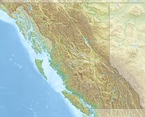
Enid Creek Cone is a subglacial mound in northwestern British Columbia, Canada , located in the Dark Mountain area. It last erupted during the Pleistocene epoch.[1]
See also
- List of volcanoes in Canada
- List of Northern Cordilleran volcanoes
- Volcanism of Canada
- Volcanism of Western Canada
References
 |


