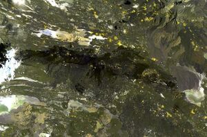
Earth:Manda-Inakir
From HandWiki
| Manda-Inakir ماندا-إناكير | |
|---|---|
 Manda-Inakir lava flows | |
| Highest point | |
| Elevation | 600+ metres (1,968 feet) |
| Coordinates | [ ⚑ ] 12°38′N 42°20′E / 12.633°N 42.333°E |
| Geography | |
| Location | Djibouti, Eritrea and Ethiopia |
| Geology | |
| Age of rock | Historical |
| Mountain type | Fissure vents |
| Last eruption | 1928 |
Manda-Inakir (Arabic: ماندا-إناكير) is a system of fissure vents and cinder cones located along the borders between Djibouti, Eritrea and Ethiopia. Last erupting in 1928, it produced a cinder cone called Kammourta. It has an elevation of over 600 metres.
See also
- Emba Soira
References
- "Manda-Inakir". Smithsonian Institution. https://volcano.si.edu/volcano.cfm?vnum=221122.
- Manda-Inakir
 |

