Earth:Mount Barnard (Alsek Ranges)
From HandWiki
Short description: Mountain in Alaska and British Columbia
| Mount Barnard | |
|---|---|
| Boundary Peak 160 | |
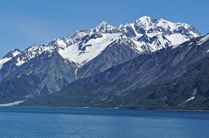
 Summit centered behind | |
| Highest point | |
| Elevation | 8,173 ft (2,491 m) [1] |
| Prominence | 3,678 ft (1,121 m) [1][2] |
| Listing |
|
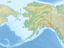
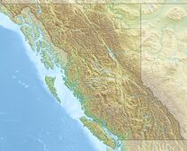
| Coordinates | [ ⚑ ] : 59°06′07″N 136°58′12″W / 59.10194°N 136.97°W [3] |
| Geography | |
Stikine Region, British Columbia Glacier Bay National Park and Preserve, Alaska | |
| Parent range | Alsek Ranges |
| Topo map | |
Mount Barnard, also named Boundary Peak 160, is a mountain in Alaska and British Columbia, located on the Canada–United States border, and part of the Alsek Ranges of the Saint Elias Mountains.[2] In 1923 Boundary Peak 160 was named Mount Barnard in honour of Edward Chester Barnard, a U.S. Boundary Commissioner from 1915 to 1921 and chief topographer of the United States and Canada Boundary Survey from 1903 to 1915.[4] The first ascent of Mount Barnard was made on August 24, 1966, from the head of Tarr Inlet[5] by D. Kenyon King, Peter H. Robinson and David P. Johnston. The details on file with Peak Service at Bartlett Cove, Glacier Bay National Monument, Gustavus, Alaska. [6]
See also
- List of Boundary Peaks of the Alaska–British Columbia/Yukon border
References
- ↑ 1.0 1.1 "Mount Barnard". http://www.bivouac.com/MtnPg.asp?MtnId=3174.
- ↑ 2.0 2.1 "Mount Barnard, British Columbia/Alaska". http://www.peakbagger.com/peak.aspx?pid=608.
- ↑ 3.0 3.1 "Mount Barnard". BC Geographical Names. https://apps.gov.bc.ca/pub/bcgnws/names/12643.html.
- ↑ "Mount Barnard". United States Geological Survey. https://geonames.usgs.gov/apex/f?p=gnispq:3:::NO::P3_FID:1420236.
- ↑ "Skagway - Forest Service". USDA. https://www.fs.usda.gov/Internet/FSE_DOCUMENTS/fsbdev2_037857.pdf. Retrieved 2018-05-18.
- ↑ North America, United States, Alaska, Mount Barnard, Glacier Bay Climbs And Expeditions
Gallery
 |


