Earth:Fanuatapu
From HandWiki
Short description: Island in Atua District, Samoa
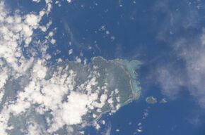
 Satellite image of the Aleipata Islands | |
| Geography | |
|---|---|
| Area | 0.06 km2 (0.023 sq mi) |
| Coastline | 1.79 km (1.112 mi) |
Fanuatapu, an uninhabited island, is a volcanic tuff ring off the eastern tip of Upolu Island, Samoa, in central South Pacific Ocean. It is the smallest and easternmost of the four Aleipata Islands, with an area of 15 hectares. It has an automated lighthouse.
See also
- Samoa Islands
- List of islands
- Desert island
References
- "Upolu". Smithsonian Institution. https://volcano.si.edu/volcano.cfm?vn=244030. (includes Fanuatapu)
[ ⚑ ] 14°00′50″S 171°24′1″W / 14.01389°S 171.40028°W
 |

