Earth:Kahauloa Crater
From HandWiki
Revision as of 00:56, 30 August 2022 by imported>LinXED (change)
Short description: Tuff cone located in Hawaii
| Kahauloa Crater | |
|---|---|
| Highest point | |
| Elevation | 92 ft (28 m) |
| Coordinates | [ ⚑ ] 21°16′35″N 157°41′23″W / 21.27639°N 157.68972°W |
| Geography | |
| Location | Honolulu County, Hawaii, United States |
| Geology | |
| Mountain type | Tuff cone |
| Last eruption | Unknown |
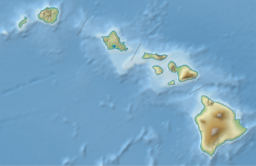
Kahauloa Crater is a tuff cone located in Hawaii. It sits between Koko Crater and Hanauma Bay.[1] The Koko Head Shooting Complex operates in its crater.[2]
Geology
Kahauloa Crater formed out of eruptions by the Koʻolau Range during its rejuvenating stage. These eruptions are known as the Honolulu Volcanic Series, which also created other nearby tuff cones such as the famous Diamond Head.
Pyroclastic units in Hanauma Bay indicate that both the craters of Hanauma and Kahauloa likely had overlapping eruptions at one point.[3]
See also
References
- ↑ "Kahauloa Topo Map in Honolulu" (in en). https://www.topozone.com/hawaii/honolulu-hi/crater/kahauloa-2/.
- ↑ Brilliant, Dave. "History | Koko Head Public Shooting Range Hawaii" (in en-US). http://khsc.info/index.php/about/history/,%20http://khsc.info/index.php/about/history/.
- ↑ Rottas, K. M.; Houghton, B. F. (September 2012). "Structure, stratigraphy, and eruption dynamics of a young tuff ring: Hanauma Bay, O'ahu, Hawai'i" (in en). Bulletin of Volcanology 74 (7): 1683–1697. doi:10.1007/s00445-012-0624-y. ISSN 0258-8900. https://ui.adsabs.harvard.edu/abs/2012BVol...74.1683R/abstract.
 |


