Earth:Štrbské pleso
| Štrbské pleso | |
|---|---|
 Štrbské pleso | |
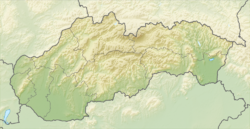
| Location | High Tatras |
| Coordinates | [ ⚑ ] : 49°07′21″N 20°03′30″E / 49.1225°N 20.05833°E |
| Type | moraine-dammed |
| rivers, streams, precipitation">Primary inflows | Underground |
| rivers, streams, evaporation">Primary outflows | Underground |
| Basin countries | Slovakia |
| Max. length | 640 m (0.40 mi) |
| Max. width | 600 m (0.37 mi) |
| Surface area | 19.76 ha (48.8 acres) |
| Max. depth | 20 m (66 ft) |
| Water volume | 1.284 hm3 (1,041 acre⋅ft) |
| Surface elevation | 1,346 m (4,416 ft) |
| Frozen | more than 155 days/year |
| Islands | Limited rocks |
| Settlements | Štrbské Pleso |
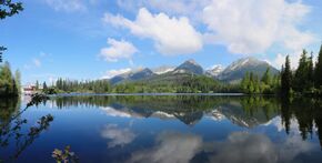
Štrbské pleso (![]() pronunciation (help·info), German: Tschirmer See, Polish: Szczyrbskie jezioro, Hungarian: Csorbató or Csorba-tó) is a picturesque mountain lake of glacial origin and a top tourist destination in the High Tatras, Slovakia. It is the second-largest glacial lake on the Slovak side of the High Tatras, after Veľké Hincovo pleso. Maximum depth is 20 metres (66 ft).
pronunciation (help·info), German: Tschirmer See, Polish: Szczyrbskie jezioro, Hungarian: Csorbató or Csorba-tó) is a picturesque mountain lake of glacial origin and a top tourist destination in the High Tatras, Slovakia. It is the second-largest glacial lake on the Slovak side of the High Tatras, after Veľké Hincovo pleso. Maximum depth is 20 metres (66 ft).
Description
Štrbské pleso is now part of the neighborhood of Štrbské Pleso (spelled with a capital P). It is on the municipal lands of the village of Štrba, after which Štrbské pleso ("Lake Štrba") is now named. The word pleso ("tarn") is applied only to mountain lakes. The locals used to call it "the puddle" or "pond" (mláka) in the past.[1] It is the second-largest glacial lake on the Slovak side of the High Tatras, after Hincovo Pleso, to which it loses by 0.8 acres (3,200 m2).[2] It is fed by underground springs and has no visible outflow stream. Its surface remains frozen for around 155 days per year.[3]
See also
| Wikimedia Commons has media related to Strbske Pleso. |
- Tatra mountains
- Tourism in Slovakia
- Vysoké Tatry (town)
References
- ↑ Miloš Janoška, Sprievodca po Tatrách. 1911.
- ↑ "Top 10 of the High Tatras". vysoke-tatry.sk
- ↑ "Štrbské pleso." Encyklopédia regiónu Vysoké Tatry. vysoke-tatry.info
 |


