Earth:Bundaberg Hummock
The Bundaberg Hummock, also referred to as The Hummock, is an extinct volcano[1] remnant situated in the locality of Qunaba east of Bundaberg, Queensland, Australia. Its official (but rarely used) name is Sloping Hummock.[2] The summit of the hill holds both a memorial to Bert Hinkler and the heritage listed Sir Anthony's Rest
History
From the deck of HMS Norfolk, Lieutenant Matthew Flinders took a bearing on a small volcanic outcrop, five kilometres to the south of Mon Repos beach. Flinders was surveying the waters between Great Sandy Island (Fraser Island) and the mainland. He named the outcrop the Sloping Hummock during his 1799 visit.[3]
In 1930, the Bundaberg branch of the Royal Automobile Club of Queensland (RACQ) acquired the land at the top of the Hummock in order to create a park for motoring tourists to enjoy the views.[4] The park was officially opened on 17 October 1931.[5]
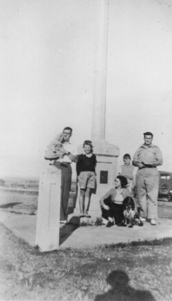
On 14 August 1937, the President of the RACQ unveiled a memorial to the Bundaberg-born aviator Bert Hinkler on the top of the Hummock.[6][7]
Geography
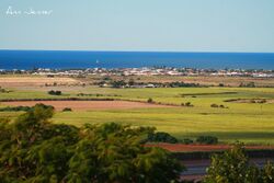
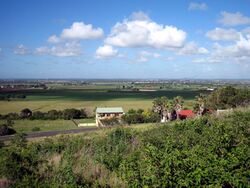
Qunaba is predominantly farming land, much of it used to grow sugarcane. It is mostly flat land with the exception of the Hummock which provides excellent views over the surrounding flat farmlands.[8][9] The sides of the Hummock have attracted residential development to take advantage of the views.[10] The fertility of the area is due to the volcanic soil from previous eruptions of the Hummock, which also left the local area scattered with volcanic rocks.
Heritage listing
The Hummock has been heritage listed as follows:
- Sir Anthony's Rest Street: Sir Anthony's Rest, a dry-stone rubble platform, constructed during the visit of the Governor of Queensland, Sir Anthony Musgrave, to Bundaberg in 1888 [8]
References
- ↑ Seach, John. "Bundaberg volcano". http://www.volcanolive.com/bundaberg.html. Retrieved 15 November 2015.
- ↑ "Sloping Hummock (entry 31177)". Queensland Place Names. Queensland Government. https://www.dnrm.qld.gov.au/qld/environment/land/place-names/search#/search=Sloping_Hummock&types=0&place=Sloping_Hummock31177.
- ↑ "South Sea Islander Wall (entry 602230)". Queensland Heritage Register. Queensland Heritage Council. https://environment.ehp.qld.gov.au/heritage-register/detail/?id=602230.
- ↑ "BUNDABERG R.A.C.Q.". Maryborough Chronicle, Wide Bay and Burnett Advertiser (Qld. : 1860 - 1947) (Qld.: National Library of Australia): p. 3. 6 August 1930. http://nla.gov.au/nla.news-article151869174. Retrieved 14 November 2015.
- ↑ "HUMMOCK LOOKOUT.". Maryborough Chronicle, Wide Bay and Burnett Advertiser (Qld. : 1860 - 1947) (Qld.: National Library of Australia): p. 5. 19 October 1931. http://nla.gov.au/nla.news-article151866899. Retrieved 14 November 2015.
- ↑ "Bert Hinkler | Monument Australia". http://monumentaustralia.org.au/display/93617-bert-hinkler. Retrieved 2015-11-14.
- ↑ "HINKLER MEMORIAL UNVEILED.". Maryborough Chronicle, Wide Bay and Burnett Advertiser (Qld. : 1860 - 1947) (Qld.: National Library of Australia): p. 6. 16 August 1937. http://nla.gov.au/nla.news-article151219372. Retrieved 14 November 2015.
- ↑ 8.0 8.1 "Sir Anthony's Rest (entry 602053)". Queensland Heritage Register. Queensland Heritage Council. https://environment.ehp.qld.gov.au/heritage-register/detail/?id=602053.
- ↑ "Sloping Hummock (entry 31177)". Queensland Place Names. Queensland Government. https://www.dnrm.qld.gov.au/qld/environment/land/place-names/search#/search=Sloping_Hummock&types=0&place=Sloping_Hummock31177.
- ↑ Template:Queensland Globe
External links
- Queensland Holiday
- Australian Explorer Photos from the Hummock
[ ⚑ ] 24°50′34.53″S 152°25′32.49″E / 24.842925°S 152.4256917°E
 |


