Earth:Capricorn Mountain
From HandWiki
| Capricorn Mountain | |
|---|---|
| Highest point | |
| Elevation | 2,551 m (8,369 ft) [1] |
| Prominence | 303 m (994 ft) [1] |
| Listing | Mountains of British Columbia |
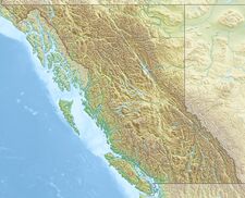
| Coordinates | [ ⚑ ] : 50°37′28″N 123°31′54″W / 50.62444°N 123.53167°W [2] |
| Geography | |
| Location | British Columbia, Canada |
| District | Lillooet Land District |
| Parent range | Pacific Ranges |
| Topo map | NTS Script error: No such module "Canada NTS". |
| Geology | |
| Age of rock | Pleistocene |
| Mountain type | Stratovolcano |
| Volcanic arc/belt | Canadian Cascade Arc Garibaldi Volcanic Belt |
| Last eruption | Pleistocene |
| Climbing | |
| First ascent | 1931 N. Carter; A. Dalgleish; T. Fyles; M. Winram[1] |
| Easiest route | Climbing |
Capricorn Mountain is one of the several volcanic peaks of the Mount Meager massif in southwestern British Columbia, Canada . The slopes of Capricorn Mountain appear to be more gentle than other volcanic peaks of the massif. The mountain consists of a boomerang-shaped ridge, with one summit on each end of the boomerang and the main summit in the centre.
See also
- List of volcanoes in Canada
- Cascade Volcanoes
- Garibaldi Volcanic Belt
- Volcanism of Canada
- Volcanism of Western Canada
References


