Earth:Double Glacier
From HandWiki
Short description: Glacier in Alaska
| Double Glacier | |
|---|---|
| Coordinates | [ ⚑ ] : 60°41′18″N 152°31′57″W / 60.68833°N 152.5325°W |
| Length | 11 mi (18 km) |
| Highest elevation | 3,491 ft (1,064 m) |
| Lua error in Module:Mapframe at line 384: attempt to perform arithmetic on local 'lat_d' (a nil value). | |
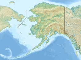
Double Glacier is an 11 mi (18 km) long glacier in the Kenai Peninsula Borough of Alaska, located 47 mi (76 km) west-northwest of Kenai. As its name suggests, Double Glacier is divided into two lobes.[1]
Double Glacier is the largest glacier contained within Lake Clark National Park with an area of 137 km2 and is in retreat. In the 2009 Redout volcano eruption the entire glacier was covered by ash.[2]
Double Glacier Volcano[3][4] lava dome complex of Pleistocene age forms a nunatak in Double Glacier. K–Ar dating of the complex indicates that it formed 627,000 to 887,000 years ago.[5]
See also
- List of glaciers in the United States
- List of volcanoes in the United States
References
- ↑ U.S. Geological Survey Geographic Names Information System: Double Glacier
- ↑ Pelto, Mauri. "professor, dean and a glaciologist". https://blogs.agu.org/fromaglaciersperspective/2018/02/05/double-glacier-alaska-retreat-double-volcanic-ash-blanket/.
- ↑ Reed, Lanphere & Miller (1992). "Double Glacier Volcano, a 'new' Quaternary volcano in the eastern Aleutian volcanic arc". Bulletin of Volcanology (October 1992) 54 (8): 631–637. doi:10.1007/BF00430776. https://link.springer.com/article/10.1007/BF00430776. Retrieved 14 October 2021.
- ↑ Pfeiffer, Tom. "Dr.". https://www.volcanodiscovery.com/doubleglacier.html.
- ↑ "Double Glacier". Smithsonian Institution. https://volcano.si.edu/volcano.cfm?vn=313800.
 |


