Earth:Elephant Butte (Utah)
| Elephant Butte | |
|---|---|
 Elephant Butte seen from Panorama Point | |
| Highest point | |
| Elevation | 5,653 ft (1,723 m) [1] |
| Prominence | 823 ft (251 m) [1] |
| Coordinates | [ ⚑ ] : 38°41′45″N 109°32′24″W / 38.695928°N 109.540032°W [1] |
| Geography | |
| Parent range | Colorado Plateau |
| Topo map | USGS The Windows Section |
| Geology | |
| Type of rock | Entrada Sandstone |
| Climbing | |
| Easiest route | Climbing class 5.4 |
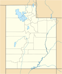
Elephant Butte[2] is a 5,653 ft summit in Grand County, Utah. It is located within Arches National Park, and is the highest point in the park. Like many of the rock formations in the park, Elephant Butte is composed of Entrada Sandstone. Elephant Butte is a flat-topped cap surrounded by numerous towers and fins including Parade of Elephants. Double Arch is also a natural feature of Elephant Butte and was used as a backdrop for the opening scene of Indiana Jones and the Last Crusade.[3] Precipitation runoff from Elephant Butte drains east into the nearby Colorado River.
Geology
Elephant Butte lies above an underground salt bed, causing the formation of the arches, spires, balanced rocks, sandstone fins, and eroded monoliths in the area. The rock is Entrada Sandstone.
Climate
Spring and fall are the most favorable seasons to experience Arches National Park, when highs average 60 to 80 °F and lows average 30 to 50 °F. Summer temperatures often exceed 100 °F. Winters are cold, with highs averaging 30 to 50 °F, and lows averaging 0 to 20 °F. As part of a high desert region, it can experience wide daily temperature fluctuations. The park receives an average of less than 10 inches (25 cm) of rain annually.
References
- ↑ 1.0 1.1 1.2 "Elephant Butte, Utah". http://www.peakbagger.com/peak.aspx?pid=3871.
- ↑ "Elephant Butte". United States Geological Survey. https://geonames.usgs.gov/apex/f?p=gnispq:3:::NO::P3_FID:1435503.
- ↑ Wilbur, Jay H.. "Natural Arches in the Movies". The Natural Arch and Bridge Society. Archived from the original on 2013-11-26. https://web.archive.org/web/20131126173533/http://naturalarches.org/movies/index.htm#indianajones.
External links
- Arches National Park National Park Service
Gallery
See also
Template:Geographic Location 2


