Earth:Hat Rock State Park
From HandWiki
Short description: State park in Oregon, United States
| Hat Rock State Park | |
|---|---|
 Hat Rock | |
| Lua error in Module:Location_map at line 522: Unable to find the specified location map definition: "Module:Location map/data/Oregon" does not exist. | |
| Type | Public, state |
| Location | Umatilla County, Oregon |
| Nearest city | Hermiston |
| Coordinates | [ ⚑ ] : 45°54′53″N 119°09′54″W / 45.9148548°N 119.1650109°W[1] |
| Operated by | Oregon Parks and Recreation Department |
Hat Rock State Park is a state park in the U.S. state of Oregon, administered by the Oregon Parks and Recreation Department. The park is located off the east side of U.S. Highway 730 in Hermiston,[2] on the south shore of Lake Wallula behind McNary Dam on the Columbia River.[3]
Flood basalt
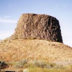
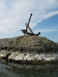
Hat Rock is a geological formation that, along with another outcropping rock in the park called Boat Rock, are thought to be exposed remnants of a 12-million-year-old basalt flow. Floods from the Ice Age eventually left these bedrocks, as well as others along the Columbia River Gorge exposed at the surface of the Earth.[4] It is 70 feet (21 meters) high.
See also
- Hermiston Butte
- List of Oregon state parks
References
- ↑ "Hat Rock State Park". United States Geological Survey. https://geonames.usgs.gov/apex/f?p=gnispq:3:::NO::P3_FID:1121655.
- ↑ Fanselow, Julie (2003). Traveling the Lewis and Clark Trail. Falcon. p. 252. ISBN 0-7627-2589-3. https://books.google.com/books?id=hDRWjVjRpogC.
- ↑ "McNary Dam and Lake Wallula". U.S. Army Corps of Engineers. http://www.nww.usace.army.mil/Missions/Recreation/McNaryDamandLakeWallula.aspx.
- ↑ Bannan., Jan Gumprecht (2002). Oregon State Parks. Mountaineers Books. p. 212. ISBN 0-89886-794-0. https://books.google.com/books?id=boFO8l8R7BsC.
External links
- "Hat Rock State Park". Oregon Parks and Recreation Department. http://www.oregonstateparks.org/park_19.php.
 |


