Earth:Hopi Buttes volcanic field
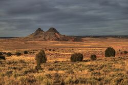
Hopi Buttes volcanic field is a monogenetic volcanic field located on the Colorado Plateau mostly on the Navajo Reservation around the town of Dilkon in northeastern Arizona north of Holbrook.
The volcanic field covers an area of approximately 965 square miles (2,500 km2) and contains about 300 maars and diatremes.[1]
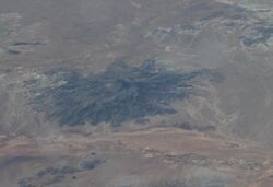
The erosional exposure of the deposits varies with those in the eastern portion exhibiting the shallowly eroded maar deposits and those in the western portion the more deeply eroded feeder diatremes. The maars result from explosive interaction of the hot diatreme material with the groundwater system and result in a mixture of volcanic tuff material and sediments of the Miocene–Pliocene lacustrine sediments of the Bidahochi Formation. In the western portion of the field the buttes consist of the feeder diatremes of monchiquite and nepheline syenite magmas.[2]
Most of the volcanic activity occurred between 8.5 and 6 million years ago, with the most recent dated at 4.2 million years ago.[3]
Notable vents
| Name | Elevation | Location | Last eruption | |
| meters | feet | Coordinates | ||
| Coliseum Maar[4] | 1,811 | 5,940 | [ ⚑ ] 35°24′N 110°06′W / 35.4°N 110.1°W | |
| Morale Claim Maar[5][6] | 1,859 | 6,100 | [ ⚑ ] 35°30′N 111°00′W / 35.5°N 111°W | |
See also
- List of volcanoes in the United States of America
References
- ↑ Geo-Ecological Study of Historic and Prehistoric Land Use in the Hopi Buttes area, Navajo Nation, Arizona, USGS
- ↑ Zelawksi, Mallory The Hopi Buttes volcanic field, Northern Arizona University, Flagstaff, AZ, The Arizona Geological Survey, 2010
- ↑ Volcano World, Coliseum Maar, Hopi Buttes, Arizona
- ↑ "Coliseum Maar, Hopi Buttes, Arizona". Volcano World, North Dakota and Oregon Space Grant Consortia. Archived from the original on 2008-09-26. https://web.archive.org/web/20080926113910/http://volcano.oregonstate.edu/vwdocs/volc_images/north_america/coliseum_maar.html. Retrieved 2007-05-07.
- ↑ Wood, Charles A.; Jűrgen Kienle (1993). Volcanoes of North America. Cambridge University Press. pp. 283–284. ISBN 0-521-43811-X.
- ↑ "Morale Claim Maar, Hopi Buttes, Arizona". Volcano World, North Dakota and Oregon Space Grant Consortia. Archived from the original on 2008-09-26. https://web.archive.org/web/20080926164931/http://volcano.oregonstate.edu/vwdocs/volc_images/north_america/morale_claim.html. Retrieved 2007-05-07.
[ ⚑ ] 35°28′03″N 110°11′32″W / 35.4675°N 110.19222°W
 |


