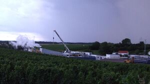
Earth:Insheim Geothermal Power Station
From HandWiki
| Geothermiekraftwerk Insheim | |
|---|---|
 Insheim Geothermal Power Station | |
| <mapframe zoom="5" frameless="1" align="center" longitude="8.1534444444444" latitude="49.153888888889" height="200" width="300">{"type":"Feature","geometry":{"coordinates":[8.153444444444444,49.153888888888886],"type":"Point"},"properties":{"marker-color":"#5E74F3","title":"Insheim Geothermal Power Station","marker-symbol":"industrial"}}</mapframe> | |
| Country | Germany |
| Location | Rhineland-Palatinate |
| Coordinates | [ ⚑ ] : 49°9′14″N 8°9′12.4″E / 49.15389°N 8.153444°E |
| Status | Operational |
| Project commissioning | 2012 |
| Owner(s) | Pfalzwerke geofuture |
| Operator(s) | Pfalzwerke geofuture |
| Geothermal power station | |
| Type | Organic Rankine cycle |
| Min. source temp. | about 160°C |
| Max. well depth | 4000 m. |
| Cogeneration? | yes |
| Thermal capacity | 6-10 MW |
| Power generation | |
| Nameplate capacity | 4.8 MW |
| External links | |
| Website | www |
The Insheim Geothermal Power Station is a geothermal power station in Rhineland-Palatinate.
The Power Station is related to earthquakes, the strongest had a magnitude of 2.4 and was registered on the 09.April.2010 10:52:22. Until 18.June.2020 154 earthquakes were registered in Insheim.[1] However, there are more earthquakes related to Insheim, one of the strongest occurred on 20.May.2020 with a magnitude of 2.2.[2] The Upper Rhine Plain has a high seismic risk and is home to the BASF, one of the biggest chemical factories in Europe.
References
- ↑ "Landeserdbebendienst Rheinland-Pfalz Erdbebenereignisse-Lokal" (in German). www.lgb-rlp.de. 2017-08-01. Archived from the original. Error: If you specify
|archiveurl=, you must also specify|archivedate=. https://web.archive.org/web/20191025232607/https://www.lgb-rlp.de/fachthemen-des-amtes/landeserdbebendienst-rheinland-pfalz/erdbebenereignisse-lokal.html. Retrieved 2017-08-01. - ↑ "Erdbeben erschüttert Insheim" (in German). 2020-05-20. https://erdbebennews.de/2020/05/erdbeben-erschuettert-insheim. Retrieved 2020-05-20.
 |

