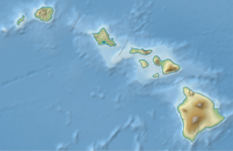
Earth:Kāohikaipu
From HandWiki
| Kāohikaipu | |
|---|---|
 Kāohikaipu as seen from Oahu, some of Mānana Island can be seen on the left | |
| Highest point | |
| Elevation | 10 m (33 ft) |
| Prominence | 10 m (33 ft) |
| Coordinates | [ ⚑ ] 21°19′13″N 157°39′23″W / 21.32028°N 157.65639°W |
| Geography | |
Hawaii, United States | |
| Geology | |
| Mountain type | Tuff cone |
| Last eruption | Unknown |
Kāohikaipu (also known as Black Rock)[1] is an islet located in Honolulu County, Hawaii. It is situated 0.6 miles away from nearby Mānana Island (Rabbit Island).[2][3] The total size of Kāohikaipu is 11 acres.[3][4]
Its formation was due to the Honolulu Volcanic Series, which were a series of eruptions by the Koʻolau Range that created numerous vents near Honolulu such as Diamond Head. Both Kāohikaipu and Mānana Island are northeast of Makapuʻu Point.
The islet is wildlife sanctuary for birds[3] and a permit is needed for people to access it.[4]
See also
References
- ↑ Cazar, Allen. "The Story of the Mysterious Islands Off Oahu - Get2Hawaii ®" (in en-US). https://www.get2hawaii.com/islets-of-oahus-windward-coast/.
- ↑ "Kāohikaipu Island, Honolulu County, Hawaii, United States". https://www.mindat.org/feature-5848270.html.
- ↑ Jump up to: 3.0 3.1 3.2 "Kaohikaipu State Wildlife Sanctuary | Oahu Forestry and Wildlife Program". http://hbmpweb.pbrc.hawaii.edu/dlnr/projects/sanctuaries/kaohikaipu.
- ↑ Jump up to: 4.0 4.1 "Offshore Islet Project". http://www2.bishopmuseum.org/hbs/islets/index.asp?isl=O%27ahu&id=-8361582.


