Earth:Kollóttadyngja
From HandWiki
This article needs additional citations for verification. (May 2019) (Learn how and when to remove this template message) |
| Kollóttadyngja | |
|---|---|
| Highest point | |
| Elevation | 1,177 metres (3,862 ft) |
| Coordinates | [ ⚑ ] : 65°13′N 16°33′W / 65.217°N 16.55°W |
| Geography | |
| Location | Iceland |
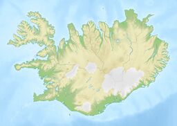
Kollóttadyngja (Icelandic pronunciation: [ˈkʰɔtlˌouhtaˌtiɲca]) is a shield volcano[1] in the Ódáðahraun lava-field in Iceland. Its height reaches 1,177 metres, and it has a diameter of 6–7 km. The summit crater is 800 metres in diameter, but only about 20–30 metres deep. In its centre, there is a bowl about 150 metres in diameter with a depth of about 60–70 metres.
See also
- Fjords of Iceland
- Geography of Iceland
- Glaciers of Iceland
- Iceland plume
- List of lakes of Iceland
- List of islands off Iceland
- List of volcanoes in Iceland
- List of rivers of Iceland
- Volcanism of Iceland
- Waterfalls of Iceland
References
- ↑ Thordarson, Thorvaldur (January 2008). "Postglacial volcanism in Iceland". Jökull 58. http://pages.mtu.edu/~raman/papers2/Thordarson%20and%20Hoskuldsson%202008%20Postglacial%20volcanism.pdf.


