Earth:Kuntomintar
From HandWiki
| Kuntomintar | |
|---|---|
 | |
| Highest point | |
| Elevation | 828 m (2,717 ft) |
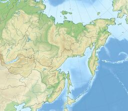
| Coordinates | [ ⚑ ] 48°45′N 154°01′E / 48.75°N 154.02°E |
| Geography | |
| Location | Shiashkotan, Kuril Islands, Russia |
| Geology | |
| Mountain type | Stratovolcano / Hydrothermal field |
| Last eruption | Unknown |
| Climbing | |
| First ascent | ? |
| Easiest route | ? |
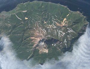
Kuntomintar (Russian: Кунтоминтар) is a stratovolcano located at the southern end of Shiashkotan Island, Kuril Islands, Russia . Kumtomintar is a high point on a small volcanic ridge with mellow slopes on all side except the north west side. The mountain is home to many steep drainages, waterfalls, and some small ponds. The crater at 1280 feet, is below the main peak, on the north west side, some periods of time hot water drains from the crater into the ocean via creek.
See also
- List of volcanoes in Russia
References

