Earth:Latukan
From HandWiki
| Latukan | |
|---|---|
| Highest point | |
| Elevation | 2,280 m (7,480 ft) [1] |
| Listing | Potentially active volcano |
| Coordinates | [ ⚑ ] : 7°39′14″N 124°26′17″E / 7.654°N 124.438°E |
| Geography | |
| Country | Philippines |
| Region | BARMM |
| Province | Lanao del Sur |
| Geology | |
| Mountain type | Stratovolcano |
| Last eruption | Pleistocene |
| Lua error in Module:Mapframe at line 384: attempt to perform arithmetic on local 'lat_d' (a nil value). | |
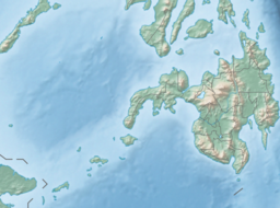
Latukan volcano is a potentially active stratovolcano in the centre of a chain of young E-W-trending[clarification needed] stratovolcanoes in northwest Mindanao, southeast of Lake Lanao, province of Lanao del Sur, island of Mindanao, in the Bangsamoro Autonomous Region in Muslim Mindanao.
The Global Volcanism Program records its elevation as 2,280 metres (7,480 ft) at a latitude of 7.654°N and longitude of 124.438°E.[1]
The Philippine Institute of Volcanology and Seismology (PHIVOLCS) lists Latukan as an inactive volcano, without any indication as to why it considers Latukan to be inactive.[2]
Like most volcanoes in southern Philippines , Latukan has not been well studied.[citation needed]
See also
- List of active volcanoes in the Philippines
- List of potentially active volcanoes in the Philippines
- List of inactive volcanoes in the Philippines
- Philippine Institute of Volcanology and Seismology
References
- ↑ 1.0 1.1 "Latukan". Smithsonian Institution. https://volcano.si.edu/volcano.cfm?vn=271050.
- ↑ "List of Inactive Volcanoes". Philippines Institute of Volcanology and Seismology (PHIVOLCS). Archived from the original on 2008-12-06. https://web.archive.org/web/20081206042918/http://volcano.phivolcs.dost.gov.ph/VolInactive.htm.


